

WebGIS3D
INconnect GmbH Utilities iPhoneiPadiPod touch
WebGIS3D is a free Utilities app for iPhone and iPad by INconnect GmbH. Requires iOS 18.6. Updated September 30, 2026.
- Price
- Free
- on the App Store
- Size
- 38 MB
- Age 4+
- Updated
- Sep 30
- 2026 · v1.0.9
Screenshots


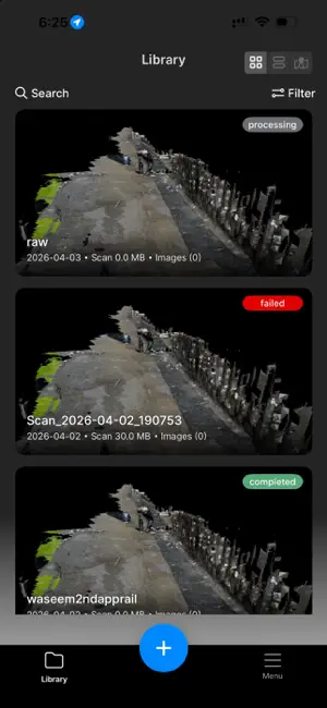
About WebGIS3D
This app transforms your iPhone into a powerful 3D scanning tool using advanced LiDAR technology. Capture accurate point clouds, generate 3D models, and measure real-world environments with precision. Whether you’re working on construction, architecture, real estate, or spatial analysis, INConnect LiDAR helps you scan and visualize spaces quickly and efficiently. Key Features: • High-precision LiDAR scanning for accurate geometry capture • Real-time point cloud visualization • Measure distances, heights, and spatial dimensions • Export scans in standard 3D formats (USDZ, PLY, etc.) • Optimized for both indoor and outdoor scanning • Fast processing and efficient data handling Built for professionals and innovators, INConnect LiDAR enables seamless 3D capture directly from your device. Note: LiDAR functionality is supported on compatible iPhone and iPad Pro devices. We continuously improve the app to deliver better performance and scan quality.
What’s new
Version 1.0.9 · Updated September 30, 2026
Fixed extra point issue
App privacy
The developer, INconnect GmbH, reported these privacy practices to Apple.
Data Not Collected
The developer does not collect any data from this app.
Alternatives to WebGIS3D
Looking for apps like WebGIS3D? Here are 6 similar apps on the App Store. The highest rated is PointFoundry (5.0/5), and 5 of the 6 are free to download.
-
 Tado Shortcuts
-
 PointFoundry
5.0
-
 Trailondo
-
 ZAPPCHA: Mobile LiDAR Scanner
3.0
-
 New Password Generator
4.7
-
 Foto-GIS new
| App | Rating | Price | Last updated | Compare |
|---|---|---|---|---|
| WebGIS3D | – | Free | September 30, 2026 | |
| Tado Shortcuts | – | 6.99 USD | Sep 22, 2026 | Compare |
| PointFoundry | 5.0 / 5 (1) | Free | Aug 8, 2026 | Compare |
| Trailondo | – | Free | Apr 1, 2026 | Compare |
| ZAPPCHA: Mobile LiDAR Scanner | 3.0 / 5 (9) | Free | Jul 10, 2026 | Compare |
| New Password Generator | 4.7 / 5 (63) | Free | Aug 31, 2026 | Compare |
| Foto-GIS new | – | Free | Oct 20, 2026 | Compare |
Compare WebGIS3D with the top alternatives: ratings, updates, ASO score and keyword gaps →