

Phoenix Guide and Subway map
Yaroslav Mykolaienko Travel iPhoneiPadiPod touch
Phoenix Guide and Subway map is a free Travel app for iPhone and iPad by Yaroslav Mykolaienko. Requires iOS 17.0. Updated September 23, 2026.
- Price
- Free
- on the App Store
- Size
- 36 MB
- Age 4+
- Updated
- Sep 23
- 2026 · v3.0
Screenshots



About Phoenix Guide and Subway map
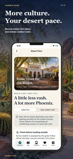
Discover Phoenix through museums, desert landscapes, neighbourhood streets and places to pause over a meal. Phoenix City Guide 2027 brings 38 places, eight city walking ideas, Valley Metro maps and a personal day planner together on your iPhone and iPad. 38 PLACES TO DISCOVER Browse sights, museums, parks, neighbourhoods, restaurants, cafes, bars and nightlife across nine area groups. Search for a destination, see it on the city map and read its story, highlights, visit notes and access information. Find the Heard Museum, Phoenix Art Museum, Musical Instrument Museum and Arizona Science Center. Discover Roosevelt Row, Heritage Square, the Japanese Friendship Garden and places beyond downtown. Original illustrations introduce the city. Official links provide visitor details. YOUR FOUR-MUSEUM CULTURE PASSPORT Keep track of visits to the Heard Museum, Phoenix Art Museum, Musical Instrument Museum and Western Spirit in Scottsdale. Mark each museum as visited and keep your progress saved on your device. Spread these destinations across your stay, with time for travel and museum visits. EIGHT CITY WALKING IDEAS Explore Heritage Square, plan a short downtown family outing or combine art museums along Central Avenue. Pair a garden with the library, discover Roosevelt Row, spend time in Old Town Scottsdale or choose a downtown meal and evening stop. Each walking idea includes a suggested sequence and practical notes. Calculate walking directions through Apple Maps, add places to My Day and adapt the outing to your time and interests. Museum entry, restaurant reservations and regional transfers are arranged separately. PAPAGO PARK AND DESERT DISCOVERIES Explore a dedicated Papago map with six discovery pins around the park and nearby attractions. Find ideas for Papago Park, Hole-in-the-Rock, Hunt's Tomb, Desert Botanical Garden, Phoenix Zoo and Hall of Flame Museum. Read place details and practical guidance, then use official park and trail information to plan your visit. The garden, zoo and museums have their own opening hours, tickets and entrances. Park pins are approximate orientation points. CHOOSE YOUR DESERT PACE Save your preference for indoor-first visits or shorter outdoor outings. Desert Pace helps you express the kind of day you want, while keeping desert trail destinations separate from automatic city walking plans. Your preference is not a live weather assessment. Check conditions, trail notices and official guidance before outdoor visits. Leave room for breaks and choose an outing that suits the conditions and your needs. VALLEY METRO MAPS AND CONNECTION IDEAS Browse a saved network with 112 routes and 7,941 stop records covering Valley Metro rail, buses, Tempe Streetcar and PHX Sky Train. Explore route shapes, stops served and station-to-station connection ideas. The planner uses stored data and illustrative travel estimates. It does not calculate current departures, service calendars, actual waiting times or accessible transfer paths. Confirm your journey, direction and fares with the operator before travelling. Find airport arrival guidance and official transport links to help prepare your onward journey. BUILD YOUR OWN PHOENIX DAYS Create multiple days in My Day, save places, reorder stops and add notes. Adjust visit durations and review distance warnings when your choices are spread far apart. Your itinerary and museum passport progress stay saved locally. FOOD, EVENINGS AND TRAVEL ESSENTIALS Browse Eat & Night for restaurants, coffee, bars and evening venues. Find weather, local time and practical planning information, plus external links for tours, tickets, car hire and mobile data. Place descriptions, illustrations, saved plans and stored transport data are available locally. Maps, new walking directions, weather and external services need internet access. This independent guide contains advertising and is not affiliated with transport operators or attractions. Make your next Phoenix day your own.
What’s new
Version 3.0 · Updated September 23, 2026
- Updated app design. - Updated advertising. - Updated maps.
App privacy
The developer, Yaroslav Mykolaienko, reported these privacy practices to Apple.
Data Used to Track You
The following data may be used to track you across apps and websites owned by other companies:
- Location: Coarse Location
Data Not Linked to You
The following data, which may be collected but is not linked to your identity, may be used for the following purposes:
- Location: Coarse Location
Used for: Other Purposes
Alternatives to Phoenix Guide and Subway map
Looking for apps like Phoenix Guide and Subway map? Here are 6 similar apps on the App Store. The highest rated is ParkQuest: National Park Log (5.0/5), and 5 of the 6 are free to download.
-
 Great Arizona State Parks
-
 Sunspire
-
 ParkQuest: National Park Log
5.0
-
 Aspenwood
-
 Dorado Canyon
-
 SAN Next Bus
1.0
| App | Rating | Price | Last updated | Compare |
|---|---|---|---|---|
| Phoenix Guide and Subway map | – | Free | September 23, 2026 | |
| Great Arizona State Parks | – | 1.99 USD | Jun 20, 2025 | Compare |
| Sunspire | – | Free | Jun 13, 2026 | Compare |
| ParkQuest: National Park Log | 5.0 / 5 (5) | Free | Sep 22, 2026 | Compare |
| Aspenwood | – | Free | Jun 13, 2026 | Compare |
| Dorado Canyon | – | Free | Jun 13, 2026 | Compare |
| SAN Next Bus | 1.0 / 5 (3) | Free | Aug 18, 2026 | Compare |