

Miami Guide and Subway map
Yaroslav Mykolaienko Travel iPhoneiPadiPod touch
Miami Guide and Subway map is a free Travel app for iPhone and iPad by Yaroslav Mykolaienko. Requires iOS 17.0. Updated September 26, 2026.
- Price
- Free
- on the App Store
- Size
- 34 MB
- Age 4+
- Updated
- Sep 26
- 2026 · v2.0
Screenshots


About Miami Guide and Subway map
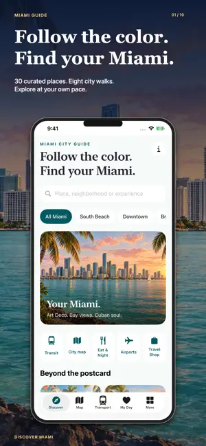
Discover Miami with a travel guide that brings beaches, neighbourhoods, Metro maps, walking ideas and your daily itinerary together. Explore South Beach architecture, Wynwood art, Little Havana flavours and bayfront museums, then save your favourite places for a day that feels like yours. Plan a beach break, a pre-cruise day or a longer stay on iPhone and iPad. FIND YOUR SIDE OF MIAMI Browse 38 selected places across Greater Miami, including sights, museums, parks, restaurants, cafes, bars and nightlife. Search by name, filter by area and open illustrated guides with practical notes, addresses, highlights and official websites. Explore Ocean Drive, Vizcaya, the Design District, Coconut Grove and other places that give each part of the city its character. MAKE TIME FOR MIAMI BEACH Use a dedicated Miami Beach collection to plan around Art Deco architecture, Lummus Park, Lincoln Road, museums and gardens. Choose a compact outing with time for the oceanfront. Miami Beach is separate from the mainland: Metrorail and Metromover do not serve the beach, so check the bus or road journey before setting out. SOUTH POINTE, AT YOUR OWN PACE Explore South Pointe Park with a discovery map and six orientation points, from the arrival area and lawns to the waterfront, pier approach and beach approach. Read the notes, choose a stop and add it to My Day. Follow public paths, check current park access and leave room for a pause beside the water. EIGHT WALKING IDEAS Choose a South Beach architecture walk, a bayfront museum day, a Wynwood art-and-coffee outing or a Calle Ocho afternoon. Eight curated sequences help you explore one area at a time. Request walking directions through Apple Maps and adapt the plan to your energy, interests and the weather. Museum admission, restaurant reservations and guided tours are separate. YOUR MIAMI COLOUR PASSPORT Mark four creative neighbourhood stops as visited: Ocean Drive and Art Deco, Wynwood Walls, Little Havana and the Design District. Track your progress on your device and open each place to learn more. The passport is a collection of separate outings, not a single walking loop across the bay. BUILD A PERSONAL TRIP PLAN Save places to My Day, create multiple days, reorder stops, write notes and adjust visit durations. Keep a museum morning, a park visit and dinner together, or split your plans between the mainland and Miami Beach. Distance warnings flag stops that are too far apart. Saved plans stay on your device, ready to revisit during your trip. METRORAIL, METROMOVER AND BUS MAPS Browse a stored transport reference with Metrorail, Metromover, MIA Mover, bus and trolley routes. Explore stops and route maps, and investigate Metrorail connections with the rail planner. Bus and Metromover information is available for browsing, with links to official operators. The transport reference is a saved snapshot, not live arrivals or a current timetable. Rail journey times are illustrative estimates. Check official schedules, service changes and transfer arrangements before travelling. FOOD, CULTURE AND EVENINGS Find ideas for Cuban food, neighbourhood coffee, a planned restaurant visit or an evening venue. Pair art with a cafe stop, browse museums and gardens, or save a place for later. Check opening hours, reservations, event programmes and age requirements through the venue's official website. ARRIVE WITH A PLAN Read guidance for Miami International (MIA), Fort Lauderdale-Hollywood (FLL) and PortMiami. Check local time and weather, explore travel essentials and browse links to tours and experiences. Provider websites handle availability, reservations and purchases; saving a place does not make a booking. Local guide content and saved days are available offline. Maps, walking directions, weather and external services require internet. Original illustrations are artistic interpretations, not photographs. An independent Miami travel guide, not an official transit or tourism app. Contains advertising.
What’s new
Version 2.0 · Updated September 26, 2026
- Updated app design. - Updated advertising. - Updated maps.
App privacy
The developer, Yaroslav Mykolaienko, reported these privacy practices to Apple.
Data Used to Track You
The following data may be used to track you across apps and websites owned by other companies:
- Location: Precise Location
Data Not Linked to You
The following data, which may be collected but is not linked to your identity, may be used for the following purposes:
- Location: Precise Location
Used for: Other Purposes
Alternatives to Miami Guide and Subway map
Looking for apps like Miami Guide and Subway map? Here are 6 similar apps on the App Store. The highest rated is Miami Guide By Civitatis.com (4.8/5), and all 6 are free to download.
-
 Miami Guide By Civitatis.com
4.8
-
 Miami Travel Guide
4.7
-
 Miami Trolley Tracker
4.8
-
 Miami Trolleys
4.6
-
 Miami Beach Trolley Tracker
4.8
-
 City of Miami Trolley
2.1
| App | Rating | Price | Last updated | Compare |
|---|---|---|---|---|
| Miami Guide and Subway map | – | Free | September 26, 2026 | |
| Miami Guide By Civitatis.com | 4.8 / 5 (10) | Free | Dec 4, 2023 | Compare |
| Miami Travel Guide | 4.7 / 5 (218) | Free | Sep 15, 2026 | Compare |
| Miami Trolley Tracker | 4.8 / 5 (349) | Free | Sep 25, 2026 | Compare |
| Miami Trolleys | 4.6 / 5 (1,494) | Free | Aug 22, 2026 | Compare |
| Miami Beach Trolley Tracker | 4.8 / 5 (980) | Free | Sep 21, 2026 | Compare |
| City of Miami Trolley | 2.1 / 5 (64) | Free | Sep 7, 2026 | Compare |