

LiteSurvey Pro
Woncan (Hong Kong) Limited Productivity iPhoneiPadiPod touch
LiteSurvey Pro is a free Productivity app for iPhone and iPad by Woncan (Hong Kong) Limited. Requires iOS 16. Updated October 17, 2026.
- Price
- Free
- on the App Store
- Size
- 126 MB
- Age 4+
- Updated
- Oct 17
- 2026 · v2.0.2
Screenshots
About LiteSurvey Pro
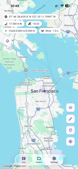
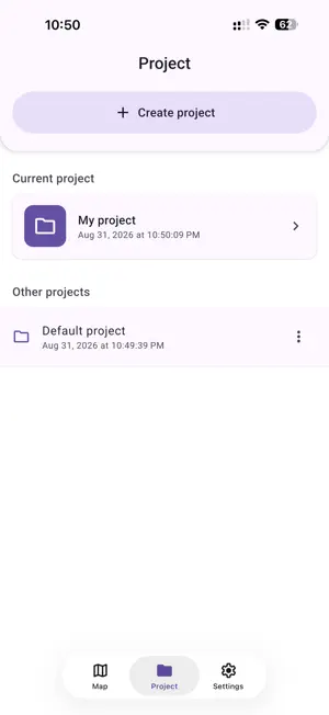
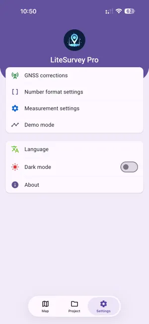
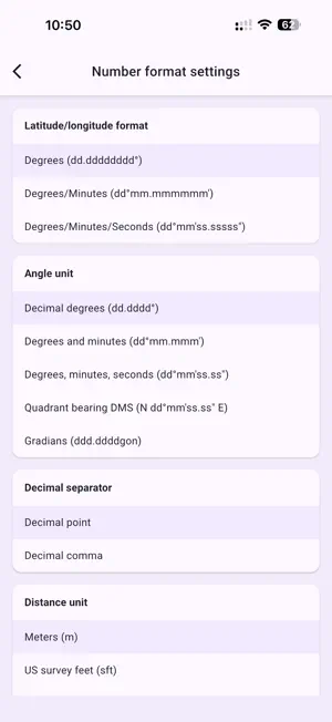
LiteSurvey Pro: Professional GNSS Surveying on iPhone and iPad LiteSurvey Pro is a field data collection app designed for use with compatible LiteSurvey GNSS receivers. It combines real-time RTK positioning, map-based GIS data capture, advanced measurement tools, and project management in a clean, modern interface optimized for iPhone and iPad. KEY FEATURES RTK GNSS POSITIONING Connect a compatible LiteSurvey GNSS receiver through supported MFi connectivity. Configure NTRIP correction services, monitor positioning solution and correction status, and support centimeter-level RTK workflows under suitable conditions. Accuracy depends on receiver hardware, correction data, satellite visibility, and the operating environment. MAP-BASED DATA COLLECTION Create and edit points, polylines, and polygons. Organize work in layers and use customizable attributes, notes, and photo attachments to build structured field datasets. ADVANCED MEASUREMENT On supported receiver models, use tilt compensation and laser ranging to capture points efficiently, including targets that are difficult to reach. Availability depends on the connected receiver and its capabilities. AR-ASSISTED PHOTO MEASUREMENT On compatible LiDAR-equipped iPhone or iPad models, connect a supported LiteSurvey GNSS receiver and use the required mounting hardware to perform AR-assisted photo measurements. Availability depends on the Apple device, receiver model, and accessories. COORDINATE SYSTEMS Use broad EPSG-based coordinate-system and transformation support for field projects, including supported geoid models, coordinate display formats, and measurement units. RECORDING AND EXPORT Export layer data as CSV and recorded tracks as GPX or KML. Record RTCM3 data and convert supported recordings to RINEX observation and navigation files for post-processing workflows. PROJECT MANAGEMENT Manage projects, layers, attributes, photos, tracks, and receiver files. Review collected features and share or export selected data when needed. HARDWARE AND COMPATIBILITY Some functions require a compatible LiteSurvey GNSS receiver, supported receiver capabilities, a LiDAR-equipped Apple device, or a dedicated mount. Feature availability varies by device and hardware. LiteSurvey Pro helps field professionals collect and manage precise GNSS and GIS data with a streamlined iPhone and iPad workflow.
What’s new
Version 2.0.2 · Updated October 17, 2026
What's New - Added Apple Maps support in the Chinese mainland. - Improved map display, zooming, feature details, and stability. - Improved geoid model management, with online downloads in supported regions. - Improved the trial process and connection experience for the built-in GNSS correction service. This service is currently available only in the Chinese mainland.
App privacy
The developer, Woncan (Hong Kong) Limited, reported these privacy practices to Apple.
Data Linked to You
The following data, which may be collected and linked to your identity, may be used for the following purposes:
- Identifiers: Device ID
- Other Data: Other Data Types
- Location: Precise Location
- Diagnostics: Other Diagnostic Data
Used for: Analytics, App Functionality
Data Not Linked to You
The following data, which may be collected but is not linked to your identity, may be used for the following purposes:
- Usage Data: Product Interaction
- Diagnostics: Crash Data, Performance Data
Used for: Analytics, App Functionality
Alternatives to LiteSurvey Pro
Looking for apps like LiteSurvey Pro? Here are 6 similar apps on the App Store. The highest rated is FastXY (5.0/5), and all 6 are free to download.
-
 FastXY
5.0
-
 Pantai RTK
-
 HAPPY-Q
-
 GNSS Log App
4.9
-
 COGO: Land Survey Calculator
5.0
-
 Surveying Leveling Field Notes
4.6
| App | Rating | Price | Last updated | Compare |
|---|---|---|---|---|
| LiteSurvey Pro | – | Free | October 17, 2026 | |
| FastXY | 5.0 / 5 (3) | Free | Sep 30, 2026 | Compare |
| Pantai RTK | – | Free | May 5, 2024 | Compare |
| HAPPY-Q | – | Free | Aug 6, 2026 | Compare |
| GNSS Log App | 4.9 / 5 (16) | Free | Oct 2, 2026 | Compare |
| COGO: Land Survey Calculator | 5.0 / 5 (1) | Free | Oct 16, 2026 | Compare |
| Surveying Leveling Field Notes | 4.6 / 5 (5) | Free | Aug 9, 2026 | Compare |
Compare LiteSurvey Pro with the top alternatives: ratings, updates, ASO score and keyword gaps →