

Mountain Maps: Hiking
MountainMaps SRL Navigation iPhoneiPadiPod touch
Mountain Maps: Hiking is a free Navigation app for iPhone and iPad by MountainMaps SRL. Rated 5.0/5 from 2 ratings. Requires iOS 15.5.
- Rating
- 5.0
- 2 ratings
- Price
- Free
- on the App Store
- Size
- 245 MB
- Age 4+
- Updated
- Nov 11
- 2026 · v6.6.4
Screenshots


About Mountain Maps: Hiking
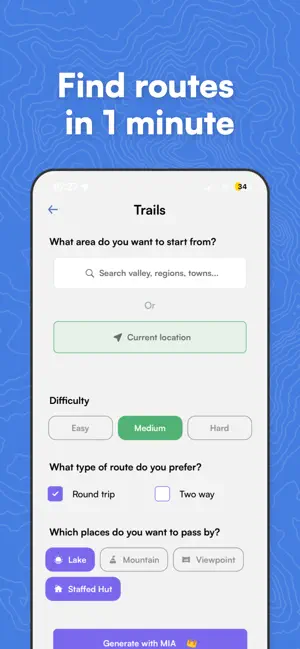
Mountain Maps is the app that takes you to the mountains any time of year. Find the perfect hike for you by asking, not by scrolling: just describe what you're looking for to MIA, our AI. NEW: MIA, YOUR AI GUIDE, IS NOW EVEN BETTER Describe the route you have in mind and watch it appear on the map. Today MIA understands requests like these too: ⇢ Create a hike that takes me to Rifugio Locatelli. ⇢ Take me to a mountain hut in under 3 hours, starting from Madonna di Campiglio. ⇢ Find a circular hike in Val Fiscalina with no more than 700 m of elevation gain. You tell the adventure, MIA draws it on the map. —————— WHAT YOU CAN DO WITH MOUNTAIN MAPS —————— ⇢ Pick a destination and let the trail come to you. You point to the place you want to reach and Mountain Maps instantly suggests the best route to get there. ⇢ Always know what lies ahead on the trail With the Trail Hazards feature you see real-time reports left by other hikers: obstacles, landslides, exposed sections, closed trails. Come across something? A few taps are all it takes to warn whoever walks after you. ⇢ Plan your trek from A to B Build your route just the way you like: Start and end points Waypoints along the way "Avoid via ferratas" filter Analysis of elevation gain, gradient and terrain type ⇢ Find new hikes made for you You're not limited to routes already created by others: MIA draws a personalised itinerary for you, matched to your pace and your urge to explore. ⇢ Walk even without signal Download offline maps of all of Europe, navigate with no coverage and use GPS even in the most remote areas. ⇢ The mountains are with you all year round Snow on the way? Plan routes on the slopes, see lifts and runs, use the "Avoid black runs" filter and check gradients and snow conditions. Perfect for ski touring and snowboarding too. —————— A GPS NAVIGATOR FOR THE MOUNTAINS —————— Your smartphone becomes a hiking navigator: ⇢ Real-time GPS position ⇢ Navigation along your planned route ⇢ Your routes and favourite spots always with you —————— DETAILED TOPOGRAPHIC MAPS OF ALL EUROPE —————— Contour lines 3D terrain view Gradient layer and snow layer Free offline maps —————— GOT A GPX TRACK? —————— Import GPX files, export your routes and sync with devices like Garmin. —————— FREQUENTLY ASKED QUESTIONS —————— Is Mountain Maps only for summer hiking? No, it's with you all year round, with precise info on snow along the route too. Can I avoid the tougher sections? Yes. Filter out via ferratas or black runs and check gradients and elevation before you set off. Is it good for beginners? Yes. Clear data on gradient, terrain and reports help you choose the right route for your level. Can I use it instead of the usual hiking apps? Yes. Mountain Maps brings together AI guide, planning, GPS navigation, terrain analysis, real-time reports and offline maps in a single app. Download Mountain Maps and turn every mountain outing into an adventure to live all the way to the top. Terms of Use: https://www.apple.com/legal/internet-services/itunes/dev/stdeula/ This app uses background location even when the app is not open to allow the user to use navigation.
What’s new
Version 6.6.4 · Updated November 11, 2026
What's new in this version of Mountain Maps • See details for ski runs and lifts. • Ask Mia to plan more than one hike at a time. You'll find them all in your history. • If you close the app while Mia is working, you'll get a notification when your route is ready. • Your profile has a new look: clearer and tidier.
App privacy
The developer, MountainMaps SRL, reported these privacy practices to Apple.
Data Used to Track You
The following data may be used to track you across apps and websites owned by other companies:
- Contact Info: Email Address, Name
Data Linked to You
The following data, which may be collected and linked to your identity, may be used for the following purposes:
- Contact Info: Email Address, Name
- Location: Precise Location
Used for: Product Personalization, App Functionality
Alternatives to Mountain Maps: Hiking
Looking for apps like Mountain Maps: Hiking? Here are 6 similar apps on the App Store. The highest rated is Outdoor Trentino (4.9/5), and all 6 are free to download.
-
 georesq
-
 Outdoor Trentino
4.9
-
 Skiarea Madonna di Campiglio
4.9
-
 Cammini di Italia
-
 TABACCOmapp
2.3
-
 Autoguidovie
3.5
| App | Rating | Price | Last updated | Compare |
|---|---|---|---|---|
| Mountain Maps: Hiking | 5.0 / 5 (2 ratings) | Free | November 11, 2026 | |
| georesq | – | Free | Oct 13, 2026 | Compare |
| Outdoor Trentino | 4.9 / 5 (7) | Free | Feb 21, 2024 | Compare |
| Skiarea Madonna di Campiglio | 4.9 / 5 (12) | Free | Aug 16, 2026 | Compare |
| Cammini di Italia | – | Free | Nov 6, 2026 | Compare |
| TABACCOmapp | 2.3 / 5 (9) | Free | Jun 9, 2025 | Compare |
| Autoguidovie | 3.5 / 5 (13) | Free | Sep 16, 2026 | Compare |