

EasyView
Syslor Utilities iPhoneiPadiPod touch
EasyView is a free Utilities app for iPhone and iPad by Syslor. Requires iOS 15.0. Updated August 26, 2026.
- Price
- Free
- on the App Store
- Size
- 301 MB
- Age 4+
- Updated
- Aug 26
- 2026 · v6.2.0
Screenshots



About EasyView
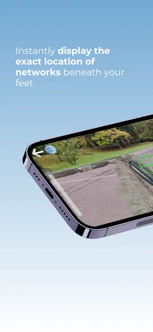
Visualize your underground utilities in augmented reality for enhanced precision and safety. EasyView turns your iPhone or iPad into a 3D visualization tool for underground networks, right on site. With augmented reality and GNSS precision, you mark, stake, and maintain markings in seconds, while reducing damages and delays. An immersive, intuitive, ready-to-use solution with unlimited usage. EasyView redefines how you interact with underground networks: instantly display the exact location of utilities beneath your feet, overlaid on your camera's real-time view. Gain efficiency and safety during marking, staking, and maintenance operations. Key features: - 3D augmented reality visualization of underground utilities with their accuracy class - Simplified marking and staking: locate and mark faster, with less risk of damage. - Integrated marking report: certify your interventions and track maintenance directly from the app. - Utility plan conversion and visualization: import your files (DXF, DWG, IFC, OBJ, SHP, StaR-DT) and display them in augmented reality. - Multi-receiver GNSS compatibility: works with Proteus (Syslor), Pyx (Teria), Reach RX and Reach RS3 (Emlid). Designed for all field stakeholders: - Site managers: secure your operations and reduce the risk of asset damage. - Surveyors: supervise marking and staking remotely, with certified data. - Field operators: visualize your networks directly on site, without technical expertise. EasyView advantages: - Damage reduction: precise visualization for safer marking. - Time savings: reduce your marking and maintenance times by four. - Centimeter-level GNSS precision: CCTA certified, adapted to network operators' requirements. - Ease of use: intuitive, no surveying background required. - Enhanced safety: immersive and reliable visualization for your teams. - Complete interoperability: DXF, DWG, IFC, OBJ, SHP, StaR-DT formats. EasyView runs on iPhone and iPad, connected to your preferred GNSS receiver (Proteus, Pyx or Reach RS3/RX). Dive into your underground networks and visualize them at real scale, wherever you are. Discover EasyView in action or request a demonstration at www.syslor.net/en/our-solutions/easyview/#DemoEasyView
What’s new
Version 6.2.0 · Updated August 26, 2026
The connection to your GNSS/RTK receiver is now permanent. Bug fixes and various improvements.
App privacy
The developer, Syslor, reported these privacy practices to Apple.
Data Not Linked to You
The following data, which may be collected but is not linked to your identity, may be used for the following purposes:
- Location: Precise Location
- Contact Info: Email Address
- User Content: Photos or Videos
Used for: App Functionality
Alternatives to EasyView
Looking for apps like EasyView? Here are 6 similar apps on the App Store. The highest rated is Moonraker Buddy (5.0/5), and all 6 are free to download.


| App | Rating | Price | Last updated | Compare |
|---|---|---|---|---|
| EasyView | – | Free | August 26, 2026 | |
| myCitylone | – | Free | Sep 2, 2026 | Compare |
| PAM tools | – | Free | Apr 10, 2026 | Compare |
| JeBalise | – | Free | May 20, 2026 | Compare |
| Moonraker Buddy | 5.0 / 5 (2) | Free | Sep 15, 2026 | Compare |
| Invoice Maker: Simple | – | Free | Jul 24, 2025 | Compare |
| KUIKOTO | – | Free | Jun 22, 2026 | Compare |
Compare EasyView with the top alternatives: ratings, updates, ASO score and keyword gaps →