

OpenTracks - Itineraries & GPS
Cyril Grandjean Travel iPhoneiPadiPod touch
OpenTracks - Itineraries & GPS is a free Travel app for iPhone and iPad by Cyril Grandjean. Requires iOS 11.0. Updated August 19, 2025.
- Price
- Free
- on the App Store
- Size
- 139 MB
- Age 17+
- Updated
- Aug 19
- 2025 · v2.2.23
Screenshots

About OpenTracks - Itineraries & GPS
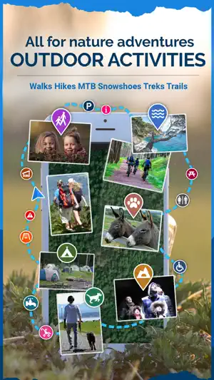
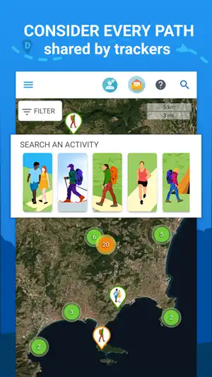
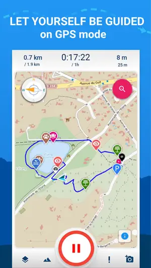
YOU ARE LOOKING FOR NATURE HIKES to plan with your family or friends: OpenTracks is a young community of routes sharing in French Riviera, gradually throughout France and around the world. With its free application and its integrated GPS, it will guide you on all your adventures! JOIN THE COMMUNITY AND BECOME A TRUE TRACKER! Discover, realize and comment on the suggested routes. You can also create and share your Sunday walks, your prettiest hikes, your favorite snowshoeing or mountain bike routes, and for the most committed, your treks and trails. OPENTRACKS IS FOR EVERYONE: beginners and enthusiasts, adults and teenagers, babies in strollers and toddlers, 4-legged friends... With its keyword search, difficulty and proximity search, find the ride or hike that suits you. Our 1st OBJECTIVE: SIMPLIFYING YOUR LIFE to practice with others a physical activity regularly. An email sent or a group created, and presto! some companions found and an activity planned. Then, just go to the start, and follow the route using your smartphone. Car parks, viewpoints, playgrounds, picnic tables, lakes and rivers ... all shared information is located on the map. You always know where you are and what remains to be done. Our 2nd OBJECTIVE: GIVE EVERYONE A REASON TO EXERCISE by approaching sport in a more friendly and fun way with badges and points. Physical activities are associated with new experiences: rediscover forgotten historic monuments, find and contemplate remarkable trees, observe wild animals or vegetation. Nature is within everyone's reach, so let’s give the benefit to the largest number of people! Main features: A GPS ON YOUR MOBILE PHONE - live display of your position, kilometers travelled and time spent - alert sent on your phone when you deviate from the selected path or your are near a localized point of interest - map areas and activity path available for offline (two levels of zoom) ACTIVITY CREATION ACCORDING TO YOUR WISHES - Live recording of a new route from your mobile phone, even without internet connection - Point by point drawing on map, for personalized route planning - Tracks import from other connected devices (GPX), automatic geolocalisation of your photos You can keep this private or share it with all trackers! A REEL COMMUNITIE: TALK, SHARE AND CONNECT - Discussion place: post questions, opinions, tips and experiences on groups, hikes or rides and get in touch with tracker’s community - Public, private or restricted groups creation - with instant messaging - to help you organize your next nature outing ACTIVITY SEARCH, LOCALIZED INFORMATION, MAPS… EASY TO USE - Localised and criterised search of strolls, hikes, treks, trails, snowshoeing or mountain biking paths - Activity bookmarking and sharing: inform your relatives of your next outing and send them the result of your exploits - Animated display of the path, with photos, practical informations, points of interest, description and elevation, on 2D or 3D view - Topographical map (OpenTopo), Hike & Bike and satellite maps (OpenStreetMap) - Inspiring trackers, friends and whole community’s latest hikes and rides - Find out more by installing our free application!
What’s new
Version 2.2.23 · Updated August 19, 2025
Bug fixes.
App privacy
The developer, Cyril Grandjean, reported these privacy practices to Apple.
Data Linked to You
The following data, which may be collected and linked to your identity, may be used for the following purposes:
- Usage Data: Product Interaction
- Location: Precise Location, Coarse Location
- Contact Info: Physical Address, Email Address, Name
- User Content: Photos or Videos, Other User Content
- Identifiers: User ID
Used for: Analytics, App Functionality
Alternatives to OpenTracks - Itineraries & GPS
Looking for apps like OpenTracks - Itineraries & GPS? Here are 6 similar apps on the App Store. The highest rated is OpenStreets 4 Open Street Map (4.8/5), and all 6 are free to download.
-
 Open GPX Tracker
4.3
-
 OpenStreets 4 Open Street Map
4.8
-
 Geo Tracker - GPS Tracker
4.4
-
 OsmAnd Maps Travel & Navigate
4.6
-
 Organic Maps・Offline Maps, GPS
4.7
-
 Bikemap: Bicycle Tracker & GPS
4.7
| App | Rating | Price | Last updated | Compare |
|---|---|---|---|---|
| OpenTracks - Itineraries & GPS | – | Free | August 19, 2025 | |
| Open GPX Tracker | 4.3 / 5 (133) | Free | Dec 21, 2025 | Compare |
| OpenStreets 4 Open Street Map | 4.8 / 5 (20) | Free | Aug 25, 2024 | Compare |
| Geo Tracker - GPS Tracker | 4.4 / 5 (55) | Free | Aug 3, 2026 | Compare |
| OsmAnd Maps Travel & Navigate | 4.6 / 5 (5,693) | Free | Oct 14, 2026 | Compare |
| Organic Maps・Offline Maps, GPS | 4.7 / 5 (3,574) | Free | Oct 1, 2026 | Compare |
| Bikemap: Bicycle Tracker & GPS | 4.7 / 5 (9,555) | Free | Oct 3, 2026 | Compare |