

Trap.nz
Groundtruth Limited Productivity iPhoneiPadiPod touch
Trap.nz is a free Productivity app for iPhone and iPad by Groundtruth Limited. Requires iOS 16.6. Updated July 7, 2026.
- Price
- Free
- on the App Store
- Size
- 43 MB
- Age 4+
- Updated
- Jul 7
- 2026 · v6.4.12
Screenshots


About Trap.nz
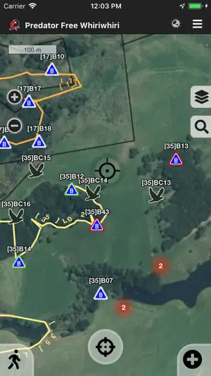
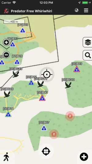
Trap.nz is the collaboration tool of choice in the march toward Predator Free 2050. Used and funded by many of NZ's regional councils it provides project coordinators, volunteers, and landowners the ability to each play a core role in dramatically improving the environment we live in. The app is your on the ground tool for mapping, locating and managing trap, monitoring site and bait station records: - Simplified data entry (no more spreadsheets) - Seamless on-line / off-line synchronisation (no network coverage required) - Built in 5 minute bird count functionality - Real time status of installations - Scheduling and daily logs - An array of base maps including topographic, street, aerial and parcel boundaries - Integration with many remote monitoring tools (such as econode and celium) To get started you will need a Trap.NZ account and a project. It's free, so sign up and join or create a project at https://trap.nz, then see our App help section - https://trap.nz/help/app. Trap.nz takes away the need for in-house GIS skills and for larger projects removes the many hours of managing spreadsheets. Providing evidence and accountability for funding becomes trivial. With a Trap.nz project you get: - User management (control access levels, assign traps etc) - Access to powerful reporting including Heat Maps (all at the click of a button) - Printable maps (great for non-techy team members) - Reporting across multiple projects - Import and export data at any time (for use in other systems) Trap.NZ is provided by the passionate folk at Groundtruth Ltd with the amazing support of: Northland Regional Council Auckland Council Hawkes Bay Regional Council Taranaki Regional Council Predator Free Wellington Taranaki Mounga Project Project Janzoon Manaaki Whenua (Landcare Research) NEXT foundation Regional Council Biomanagers Group WWF
What’s new
Version 6.4.12 · Updated July 7, 2026
NFC / QR enabled for bait stations, monitoring stations, points of interest Fix for parcel boundaries layer display
App privacy
The developer, Groundtruth Limited, reported these privacy practices to Apple.
Data Not Linked to You
The following data, which may be collected but is not linked to your identity, may be used for the following purposes:
- Location: Precise Location, Coarse Location
- Diagnostics: Crash Data, Other Diagnostic Data
- Contact Info: Physical Address, Email Address, Name, Phone Number
Used for: App Functionality, Other Purposes