

Plants of South Eastern NSW
LucidMobile Reference iPhoneiPadiPod touch
Plants of South Eastern NSW is a free Reference app for iPhone and iPad by LucidMobile. Requires iOS 15.6. Updated October 7, 2025.
- Price
- Free
- on the App Store
- Size
- 117 MB
- Age 4+
- Updated
- Oct 7
- 2025 · v1.5.1
Screenshots
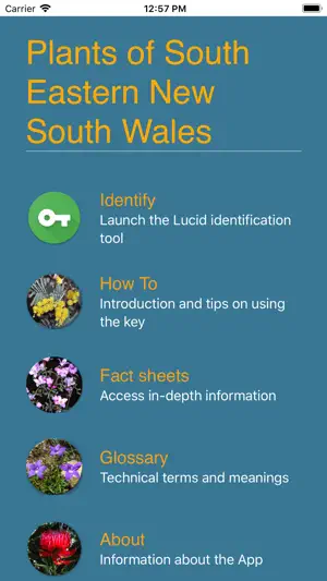

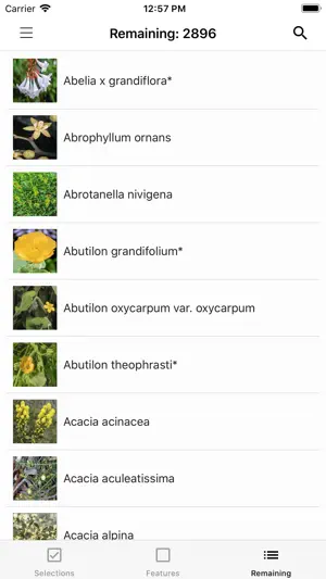
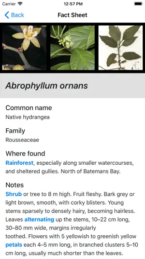
About Plants of South Eastern NSW
This key is designed for anyone who has an interest in finding out about the plants of south eastern New South Wales. It includes 3209 species, accompanied by about 15,000 images. The key uses a limited number of easily seen characters using a minimum of technical terms to help with identification of plants. It is not designed to key out to a single species, though sometimes it does. It is designed to narrow down the possibilities of what the plant might be to a limited number of species. The photos may then help you decide what your plant is. Routine use of a hand lens or a macro app on your mobile phone will make identification easier, in particular for the feature Number of florets/tiny flowers in a flower head. Area covered by the key The northern boundary is at 33.4° S, i.e. from Gosford and Bathurst to about 60 km NNW of West Wyalong. The western boundary is at 146.9° E, about 60 km NNW of West Wyalong to Albury. The southern boundary is the NSW/Victorian border. Plant Distributions Plant distributions are derived from the maps generated for individual species in Spatial Portal, Atlas of Living Australia https://spatial.ala.org.au/ and from personal observation, and occasionally from the NSW Department of Environment and Heritage Bionet Atlas http://www.environment.nsw.gov.au/atlaspublicapp/UI_Modules/ATLAS_/AtlasSearch.aspx. Records dated before 1 January 1983 have been disregarded. Distributions are given only for within the area covered by this key. Coastal records are from east of the escarpment west of Sydney and east of the hills inland from the Princes Highway. Records in the ranges are from the escarpment west of Sydney and the hills west of the Princes Highway to the western edges of the large national parks running south from the Blue Mountains to the Victorian border. Records on the tablelands are from west of the large national parks in the ranges to the Hume Highway. The eastern boundary of the Western Slopes runs south from north of Canowindra and along the Hume Highway to Albury. A description of the Western Slopes is at https://www.environment.nsw.gov.au/topics/animals-and-plants/biodiversity/bioregions/bioregions-of-nsw/south-western-slopes Plant Names Plant names are those in the Australian Plant Census as at March 2023. In cases where the Council of Heads of Australian Herbaria has not yet made a determination, plant names published in http://plantnet.rbgsyd.nsw.gov.au/. Where a name is not listed in PlantNET, the names in https://vicflora.rbg.vic.gov.au/ are used. About the author Betty Wood, by training a pharmacologist, developed an interest in wildflowers and their identification many years ago when she first settled in Canberra. Her mother-in-law, an English botanist, helped her to learn to use botanical keys to identify Australian plants. She is co-author (with her late husband Don) of Flowers of the South Coast & Ranges of New South Wales in three volumes, Flowers of the ACT & Region, and sole author of Simple Guide to Eucalypts and Similar Trees of the South Coast and Ranges of NSW (Including the Illawarra and Southern Highlands) and the Lucid key and app Plants and Fungi of South Western New South Wales. Feedback With about 3,000 manually entered species, there are sure to be mistakes in this key. Please advise me of such, or give me suggestions about how the key could be improved. Photos that users send me to fill in the gaps would be greatly appreciated. My email address is [email protected] This App is powered by LucidMobile, for more information please visit https://www.lucidcentral.org
What’s new
Version 1.5.1 · Updated October 7, 2025
The area covered by the key now includes a circle of 10 km radius around Orange. The common names index has been checked and revised. The Topics 'Common Names' and 'Where Found' in the Fact Sheets have been checked and revised where necessary. A number of citations, particularly for weeds and threatened species, have been changed or added. Some fact sheets have been rewritten. 38 species have been added. A number of additional alternate names have been added. A number of images have been added. The contraction subsp. (for subspecies) has been changed to ssp. in accordance with iNaturalist practice.
App privacy
The developer, LucidMobile, reported these privacy practices to Apple.
Data Not Collected
The developer does not collect any data from this app.
Alternatives to Plants of South Eastern NSW
Looking for apps like Plants of South Eastern NSW? Here are 6 similar apps on the App Store. The highest rated is Pizzey and Knight Birds of Aus (5.0/5), and 4 of the 6 are free to download.
-
 Soils Near Me NSW
-
 NatureMapr data collector
-
 NSW GeoTours
-
 NSW WeedWise
-
 Pizzey and Knight Birds of Aus
5.0
-
 Field Guide to Australian Bats
| App | Rating | Price | Last updated | Compare |
|---|---|---|---|---|
| Plants of South Eastern NSW | – | Free | October 7, 2025 | |
| Soils Near Me NSW | – | Free | Oct 28, 2025 | Compare |
| NatureMapr data collector | – | Free | Aug 27, 2025 | Compare |
| NSW GeoTours | – | Free | Aug 26, 2026 | Compare |
| NSW WeedWise | – | Free | Sep 30, 2026 | Compare |
| Pizzey and Knight Birds of Aus | 5.0 / 5 (1) | 29.99 USD | Sep 16, 2026 | Compare |
| Field Guide to Australian Bats | – | 29.99 USD | Jul 28, 2025 | Compare |