

Public transport map London
Khrystyna Skliarova Navigation iPhoneiPadiPod touch
Public transport map London is a free Navigation app for iPhone and iPad by Khrystyna Skliarova. Rated 1.0/5 from 1 ratings. Requires iOS 12.3.
- Rating
- 1.0
- 1 ratings
- Price
- Free
- on the App Store
- Size
- 88 MB
- Age 4+
- Updated
- Apr 16
- 2026 · v4.3.6
Screenshots


About Public transport map London
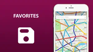
The entire London's transport infrastructure of in one app. Metro lines, trams and buses routes, transfer stations - all of those you will find inside. Search by station name or route number, saving chosen routes and geo-positioning are available in the basic version. Why do this app is should be tried? 1) On the screen of your device you will see the whole London's public transport scheme, and the more scale is choosen the more details are given. 2) The map of London shows not only metro lines, but tram and bus routes as well. Stations of possible metro-tram-bus transfers are grouped. 3) The search by station name will help you to find it on the map and select the proper transport. Search by route number allows you to quickly determine whether it suitable or not. 4) By allowing the application to access the location and mark it on the map, you will see stations nearby. So you won't ever get lost and without any help you will be able to get anywhere in the city. 5) The routes you planned in advance, can be saved in the list and you may use them again at any time. In an extended version, the app allow you: 6) To use all of the above in offline mode without wasting time searching for the wifi reception. 7) To check a short schedule of public transport routes if it is needed. 8) To know not just where the station is, but where the stops of all routes passing through are located as well. Confident use of all types of public transport is the key to the most comfortable visiting London.
What’s new
Version 4.3.6 · Updated April 16, 2026
- Platform Upgrade: We've migrated to the powerful MAUI platform, bringing enhanced performance and reliability. - Fresh New Design: Enjoy a sleek, modern interface that's more intuitive and user-friendly. - Updated Data: Access the latest and most accurate information with our improved database. - Bug Fixes & Improvements: We've squashed some bugs and fine-tuned the app to make your experience even better.
App privacy
The developer, Khrystyna Skliarova, reported these privacy practices to Apple.
Data Not Linked to You
The following data, which may be collected but is not linked to your identity, may be used for the following purposes:
- Location: Precise Location, Coarse Location
Used for: Product Personalization, App Functionality
Alternatives to Public transport map London
Looking for apps like Public transport map London? Here are 6 similar apps on the App Store. The highest rated is London Transport Live Times (5.0/5), and all 6 are free to download.
-
 London Transport Live Times
5.0
-
 UK Metro - London, Glasgow
4.7
-
 London Tube Map, Tram, DLR TFL
-
 London Travel & Audio Guide
4.8
-
 London Bus Arrival
-
 Public transport maps offline
4.1
| App | Rating | Price | Last updated | Compare |
|---|---|---|---|---|
| Public transport map London | 1.0 / 5 (1 rating) | Free | April 16, 2026 | |
| London Transport Live Times | 5.0 / 5 (2) | Free | Sep 21, 2026 | Compare |
| UK Metro - London, Glasgow | 4.7 / 5 (60) | Free | Jul 1, 2026 | Compare |
| London Tube Map, Tram, DLR TFL | – | Free | Mar 28, 2024 | Compare |
| London Travel & Audio Guide | 4.8 / 5 (12) | Free | Oct 16, 2026 | Compare |
| London Bus Arrival | – | Free | Sep 20, 2026 | Compare |
| Public transport maps offline | 4.1 / 5 (10) | Free | Apr 24, 2026 | Compare |