

国土マップR
keiji matsumoto Navigation iPhoneiPadiPod touch
国土マップR is a free Navigation app for iPhone and iPad by keiji matsumoto. Rated 5.0/5 from 1 ratings. Requires iOS 16.6. Updated June 29, 2026.
- Rating
- 5.0
- 1 ratings
- Price
- Free
- on the App Store
- Size
- 25 MB
- Age 4+
- Updated
- Jun 29
- 2026 · v1.1.0
Screenshots

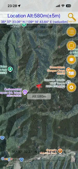
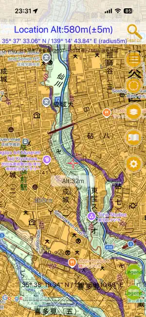

About 国土マップR
This app lets you display various maps provided by the Geospatial Information Authority of Japan. It can be used within Japan. You can display a wide range of maps, including standard topographic maps, nationwide aerial photographs, residential land use survey maps, aerial photographs taken during disasters, volcano base maps, lake maps, and more — over 160 types in total! You can display three map layers at once: an overlay map, a base map, and Google Maps. The transparency of the overlay map and base map can be adjusted freely. For maps that have legends, you can display the legend with a single tap. Maps displayed on the screen are automatically cached up to 200 MB (*), so they can also be used deep in the mountains where there is no mobile signal, or in airplane mode. The app can also be used as a simple GPS app for hiking. It includes only the minimum GPS features needed to show your current location, making it easy for anyone to use. You can easily check the elevation at the center of the screen. Please use this feature for disaster preparedness and other purposes. * When the cache exceeds the limit, older cached data is automatically deleted when the app starts. You do not need to worry about the app consuming all of your smartphone storage. ■ Notes ・Use of this app is at your own risk. ・We assume no responsibility for the accuracy, safety, or reliability of the information provided. ・Please do not contact the Geospatial Information Authority of Japan regarding this app. Maps: Geospatial Information Authority of Japan [http://www.gsi.go.jp/](http://www.gsi.go.jp/)
What’s new
Version 1.1.0 · Updated June 29, 2026
英語版です。 ・The overlay blending method has been changed to Multiply. This makes the map display sharper than before. If performance feels slow, please change it to “Settings → Blending Method → Alpha.” ・The search feature has been improved. It now saves search history and performs real-time searches. Coordinate input in latitude and longitude is also supported. For degrees, minutes, and seconds, enter them like “35/59/59.12 139/59/59.12”: use slashes to separate degrees, minutes, and seconds, enter latitude first, then a half-width space, followed by longitude. ・Banner ads are now displayed in the corner of the screen. In the future, it may become possible to hide ads through an in-app purchase.
App privacy
The developer, keiji matsumoto, reported these privacy practices to Apple.
Data Not Linked to You
The following data, which may be collected but is not linked to your identity, may be used for the following purposes:
- Diagnostics: Crash Data, Performance Data, Other Diagnostic Data
Used for: Analytics
Alternatives to 国土マップR
Looking for apps like 国土マップR? Here are 6 similar apps on the App Store. The highest rated is AR地形模型 (4.7/5), and all 6 are free to download.


| App | Rating | Price | Last updated | Compare |
|---|---|---|---|---|
| 国土マップR | 5.0 / 5 (1 rating) | Free | June 29, 2026 | |
| スーパー地形 | 4.6 / 5 (8) | Free | Aug 21, 2026 | Compare |
| Old Satellite Map JAPAN | – | Free | Aug 26, 2026 | Compare |
| GSI Map++ | – | Free | Apr 22, 2025 | Compare |
| 大江戸今昔めぐり | 3.8 / 5 (4) | Free | Nov 4, 2025 | Compare |
| Drone Maps Japan | 3.7 / 5 (11) | Free | Sep 27, 2026 | Compare |
| AR地形模型 | 4.7 / 5 (3) | Free | May 17, 2025 | Compare |
Compare 国土マップR with the top alternatives: ratings, updates, ASO score and keyword gaps →