
Gardens & Parks
Maxcom Labs Travel & Local
On a map, parks and gardens of Nantes
- Downloads
- 683+
- on Google Play
- Price
- Free
- No in-app purchases
- Updated
- Aug 13
- 2025 · v2.0.2
Screenshots


About Gardens & Parks
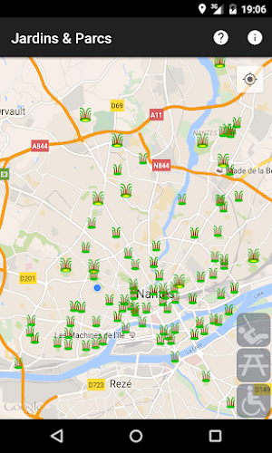
Locate on a map the parks and gardens of Nantes, France, with indicators of some of their services.
The large sites are designated by a wider marker.
You can apply filters to eliminate sites that do not offer a service.
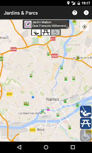
- Clicking on a marker displays a short description:
★ the name and location of the site
★ a button to launch a guidance assistance to the site
★ the level of service: presence of a playground for children, presence of furniture for picnic, accessibility to persons with physical disabilities.
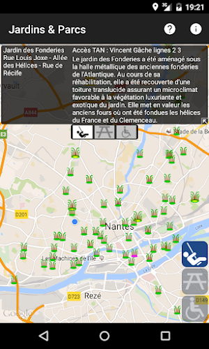
- Clicking on the description adds the following additional information (if possible):
★ access by public transport (TAN)
★ comments to describe the site.
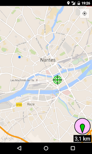
The guidance assistance to a site shows:
★ a compass, to test whether the orientation sensor is properly calibrated,
★ a marker for your current location, updated based on your travel,
★ a marker having a shape as a target, to spot the site to be reached,
★ a counter of remaining distance,
★ an arrow for the direction to take to reach the site.
Supported languages: English and French.
The information is public data, coming from the site data.nantesmetropole.fr, made available under the Open Database License (ODbL).
This application was made on the occasion of the call for projects: « Rendez-moi la ville + facile », organized in 2012 by the local public authorities for theirs public data opening steps.
The large sites are designated by a wider marker.
You can apply filters to eliminate sites that do not offer a service.
- Clicking on a marker displays a short description:
★ the name and location of the site
★ a button to launch a guidance assistance to the site
★ the level of service: presence of a playground for children, presence of furniture for picnic, accessibility to persons with physical disabilities.
- Clicking on the description adds the following additional information (if possible):
★ access by public transport (TAN)
★ comments to describe the site.
The guidance assistance to a site shows:
★ a compass, to test whether the orientation sensor is properly calibrated,
★ a marker for your current location, updated based on your travel,
★ a marker having a shape as a target, to spot the site to be reached,
★ a counter of remaining distance,
★ an arrow for the direction to take to reach the site.
Supported languages: English and French.
The information is public data, coming from the site data.nantesmetropole.fr, made available under the Open Database License (ODbL).
This application was made on the occasion of the call for projects: « Rendez-moi la ville + facile », organized in 2012 by the local public authorities for theirs public data opening steps.
What’s new
Version 2.0.2 · Updated August 13, 2025
Technical update of API levels.
Alternatives to Gardens & Parks
Looking for apps like Gardens & Parks? Here are 3 similar Android apps on Google Play. All of them are free to download.

| App | Rating | Price | Installs | Last updated | Compare |
|---|---|---|---|---|---|
| Gardens & Parks | – | Free | 500+ | Aug 13, 2025 | |
| ParcoVélo Angers | – | Free | 10+ | – | Compare |
| ParcoVélo | – | Free | 10+ | Apr 11, 2024 | Compare |
| ParcoMoto | – | Free | 100+ | – | Compare |
Compare Gardens & Parks with the top alternatives: ratings, updates, ASO score and keyword gaps →