

Timbeter Forest
Timbeter Ltd Tools
Measure standing trees with video: DBH, density, volume and carbon stock.
- Downloads
- 10+
- on Google Play
- Price
- Free
- No in-app purchases
- Updated
- Sep 21
- 2026 · v1.3.0
Screenshots


About Timbeter Forest
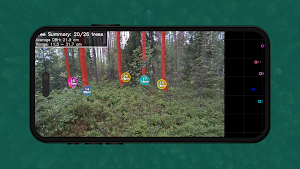
Timbeter Forest is a digital measurement tool for standing trees. Record a short video while walking through a forest plot, and let AI do the measuring: the app assesses trees in 3D and delivers audit-ready results in minutes.
HOW IT WORKS
1. Pair the device with your organization using a pairing code from the Timbeter Dashboard.
2. Record a video while walking a straight path through the plot.
3. Upload the recording — processing runs in the cloud.
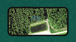
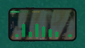
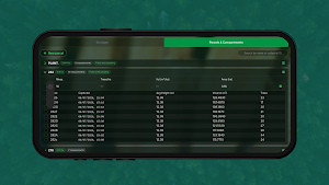
4. Review the results: every measured tree with its diameter, plus plot-level statistics.
WHAT IT MEASURES
• Diameter at breast height (DBH) for each detected tree
• Trees per hectare (density)
• Basal area and volume
• Carbon stock estimation
• Geocoordinates and timestamps for every measurement — audit-ready data
WHY VIDEO-BASED MEASUREMENT
A static photo only shows what one frame can see. Timbeter Forest processes video captured while moving, so partially obscured trees become visible and every plot covers a larger sample — bigger sample, better accuracy, less manual fieldwork.
WHO IT'S FOR
Forestry professionals and taxators, forest owners, carbon market actors, conservation organizations, researchers, and forest investors.
Timbeter Forest is currently piloting across multiple countries. The app requires a compatible device with an Intel RealSense depth camera and an organization account — contact us at [email protected] to join the pilot.
What’s new
Version 1.3.0 · Updated September 21, 2026
- Greatly reduced recording size: recordings take up much less space and upload faster - Added a storage overview: see how much space your device has and how much recordings are using Minor improvements, bug fixes, and more.
Alternatives to Timbeter Forest
Looking for apps like Timbeter Forest? Here are 5 similar Android apps on Google Play. The highest rated is Timbeter (4.0/5), and all 5 are free to download.





| App | Rating | Price | Installs | Last updated | Compare |
|---|---|---|---|---|---|
| Timbeter Forest | – | Free | 10+ | Sep 21, 2026 | |
| Timbeter Truck | – | Free | 100+ | Jul 1, 2025 | Compare |
| Timbeter Lumber | – | Free | 1,000+ | – | Compare |
| Timbeter Log Counter | – | Free | 10,000+ | – | Compare |
| Timbeter Container | – | Free | 1,000+ | Apr 9, 2025 | Compare |
| Timbeter | 4.0 / 5 | Free | 50,000+ | Sep 23, 2026 | Compare |
Compare Timbeter Forest with the top alternatives: ratings, updates, ASO score and keyword gaps →