About LEA-Foto
Are you submitting an application for area-related agricultural funding in Rhineland-Palatinate? Then use the LEA photo app to be able to react directly and easily to unclear issues in the agricultural funding application. As with LEA, registration is done using the company number and PIN. Matching the LEA funding platform, there is a mobile app for smartphone or tablet for area management. The photo app under the name LEA photo app is available to all farmers from the Ministry of Economics and Transport. Agriculture and viticulture provided free of charge.
If no clear result could be determined through satellite monitoring, you as a registered user have the option of processing this task directly in the LEA photo app. The map view makes orientation easier. You can then take several photos of the specific area. These photos help to assess the situation.
The background to this is the introduction of an area monitoring system (FMS), which is mandatory by the EU. The core of this system is the observation of agricultural areas using satellite data. The satellites check, for example, the crops grown, the requirements for minimum cultivation or the use of grassland.
Another essential component of the FMS is the cooperation between administration and applicants. Findings from the satellite data analysis should be communicated to applicants at an early stage so that they can make corrections to the application if necessary, thereby preventing violations and sanctions.
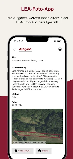
As soon as discrepancies are discovered in the satellite data analysis, the farmer receives this information in the LEA photo app and can clarify the matter in the form of tasks on the smartphone and, if necessary, make application corrections in the LEA. All you need to do is take two photos, a panoramic image and a detailed image.
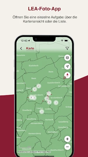
The farmer receives a quick overview of all tasks and their submission deadlines in the list view, while the map view enables quick orientation about the location of the tasks.
The LEA photo app can also be used to proactively document compliance with funding conditions, such as mulching fallow land in spring or sowing active greenery or a flowering mixture.
The agricultural promotion mobile app allows geo-referenced photos of agricultural plots to be captured, assigned and transmitted. The app was developed as a supplement to LEA for Android and iOS and can be used off-road even without an internet connection. The LEA photo app is free, easy to use and use of the LEA photo app is voluntary.
How does the FMS work specifically with the LEA photo app?
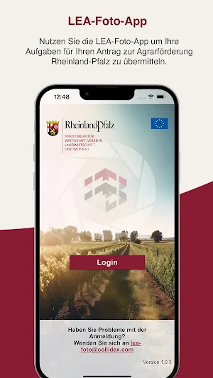
· Log in using your company number and PIN.
· Your tasks are made available to you directly in the LEA photo app.
· You can access the current status using “Update data”.
· Open a single task from card view or list.
· The LEA photo app helps you navigate to the area and supports you in processing tasks.
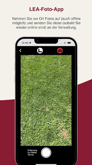
· Take photos on site (also possible offline) and send them to the administration (as soon as you are online again).
· The photos and your entries are checked there. If everything fits, an on-site inspection is no longer necessary.
Why should I use the LEA photo app?
· fewer inspection visits
· Simple correction options to avoid sanctions
· timely payment
LEA-Foto details
LEA-Foto is a free Business app for Android with 1,000+ installs on Google Play and a 5.0/5 average rating from 1 rating. It was last updated on January 23, 2026. It requires Android 9 or later.
- Category
- Business
- Rating
- 5.0 / 5 (1 rating)
- Installs
- 1,000+
- Price
- Free
- In-app purchases
- No
- Ads
- No ads
- Current version
- 1.9.0
- Requires Android
- 9
- Content rating
- Everyone
- Last updated
- January 23, 2026
What’s new in LEA-Foto
Neue Funktionen • Proaktive Geo-Fotos ohne Schlagzuordnung möglich • Automatische Vorauswahl des nächsten Schlags bei Fotoaufnahme • Dokumentenfotos können nach Aufnahme zugeschnitten werden Optimierungen • Schlagnummer statt Schlag-ID bei proaktiven Fotos • Prüfung auf erforderliche App-Mindestversion Behobene Fehler • Foto-Button in der Karte bleibt nach Aufnahme sichtbar • Senden-Button im Aufgabenformular immer sichtbar
Version 1.9.0 · Updated January 23, 2026
Similar Apps
Charter Cargo
Find chartering opportunities, cargo offers, and ship sales

Trakop Delivery 2.0
App will be used to delivery management for the delivery boy and order tracking.

APAP|NYC
The app for information and updates on the APAP|NYC conference.
Smart Hospital
Patient safety and operational efficiency increase with Smart Hospital solutions.

Motel+Gerencial
Your motel in his hands, manage and track your motel in real time.

RICS>Checkout
A point-of-sale app that enables you to move more inventory
