About AllertaTerremoto
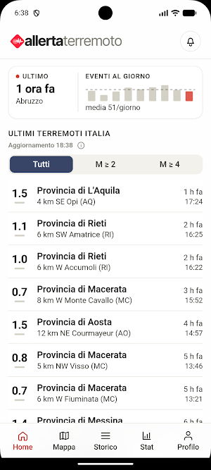
Italy trembles every day. Thousands of tremors a year, most imperceptible, some not. Earthquake Alert keeps you informed of what's happening beneath your feet with official data from the National Institute of Geophysics and Volcanology, instant notifications, and tools designed for those who want to truly understand what's happening.
Know immediately, know where
As soon as an earthquake is recorded by the INGV, Earthquake Alert alerts you. But not with indiscriminate notifications for every microseism recorded in Sicily when you're in Milan. You can configure alerts for the places that matter to you: your city, your parents' city, the places you work or travel to. For each, you set a monitoring radius and a minimum magnitude threshold. You can also activate a monitor for the whole of Italy with the threshold you prefer. The result is a tailor-made alert system, not a stream of noise.
A map that tells the story of the territory
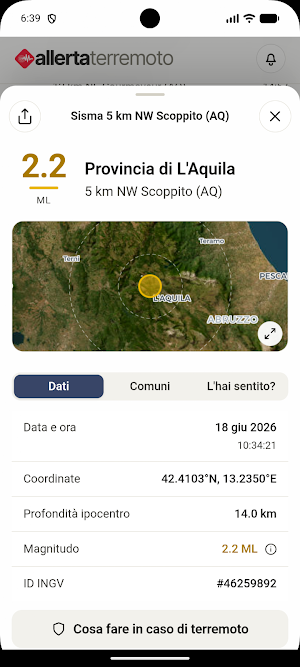
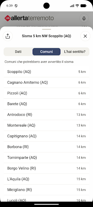
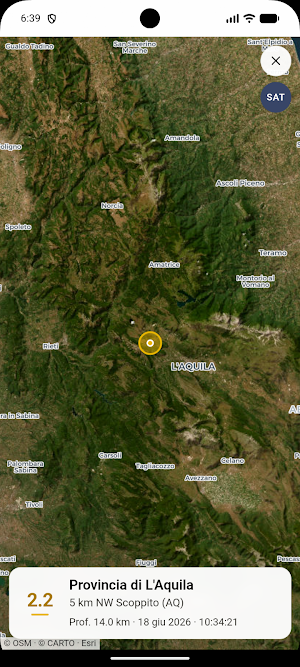
The map is the heart of the app. Earthquakes appear as dots that change color from orange to red with magnitude and grow in size with intensity—an immediate visual language that lets you understand the situation in a second. You can filter by time period (24 hours, 7, or 30 days) and threshold, switch to satellite view, and center the map on your location. If you want to dig deeper, activate thematic layers: population density, Italian volcanoes, mountain ranges, and tectonic plate boundaries. Tap a point on the map and see everything: magnitude, depth, coordinates, and the municipalities within the epicenter's radius.
History and Statistics
Italy's seismic activity has a long memory. The History section lets you search for past events by filtering by region, province, municipality, date range, and magnitude. The Statistics section transforms the data into graphs: the day-by-day trend of events with highlighted magnitude bands, the statistical distribution of tremors, the ranking of the most affected regions, and the strongest event of the period. You can choose the time frame between 7 days, 14 days, 30 days, and a full year.
Did you feel it?
If you feel a tremor, you can report it directly from the app, indicating the intensity of your experience. User reports are aggregated and displayed completely anonymously: a collective contribution that creates a map of the perception of the area, similar to the MCS scale used by seismologists.
Prepare, not just monitor
Terremoto Alert includes practical guides on how to read the magnitude scale, what to do before, during, and after an earthquake, and how INGV data publication times work. Because knowing what to do is more important than any notification.
Official data, independent app
All data comes from the National Institute of Geophysics and Volcanology (INGV), the leading scientific body for seismic monitoring in Italy. The app is developed completely independently, with no affiliation with the INGV or other public bodies.
Free. With a no-frills Premium option.
The app is free for iPhone, iPad, and Android. Premium removes ads: a cleaner, more seamless experience for those who want to support the project.
Similar Apps
AllertaMeteo
Tailor-made weather alerts

Club De Recetas
Club Recipes offers you carefully selected and curated recipes.

The Recipes Club
Italian Recipes & More...

Rezept Club
RecipeClub offers you carefully selected and curated recipes.

NewsRoom
The news that interests you, always with you!

Il Club delle Ricette
The Recipes Club offers you over 4000 recipes, selected and curated for you.
