

OrbitAR Satellite Tracker
ThoughtBloc LLC Tools
Augmented reality satellite tracker.
- Downloads
- 118+
- on Google Play
- Price
- Free
- No in-app purchases
- Updated
- Aug 12
- 2026 · v24.0
Screenshots
About OrbitAR Satellite Tracker
OrbitAR Satellite Tracker is provided free of charge with no ads, no in-app purchases, no subscriptions and no data collection.
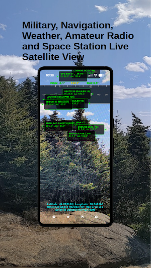
OrbitAR Satellite Tracker is an augmented reality satellite tracking application that visualizes the real-time positions of Earth-orbiting satellites directly on your device's camera view.
The operations manual is available at thoughtbloc.com -> OrbitAR Satellite Tracker.
Using satellite orbital elements, GPS positioning, and device orientation sensors, OrbitAR Satellite Tracker calculates and displays satellite locations in real time, allowing users to locate and track satellites as they move across the sky.
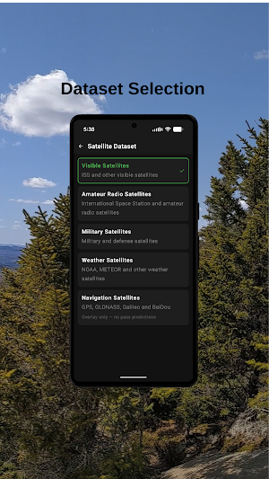
OrbitAR Satellite Tracker supports multiple satellite datasets, including visible, amateur radio, weather, navigation and military satellites.
FEATURES
• Augmented reality satellite visualization over the live camera view
• Real-time satellite position calculation using current orbital data
• Support for visible, amateur radio, weather, navigation and military satellite datasets
• Live satellite information including elevation, azimuth, Acquisition of Signal (AOS), and Loss of Signal (LOS)
• Satellite markers showing precise sky position
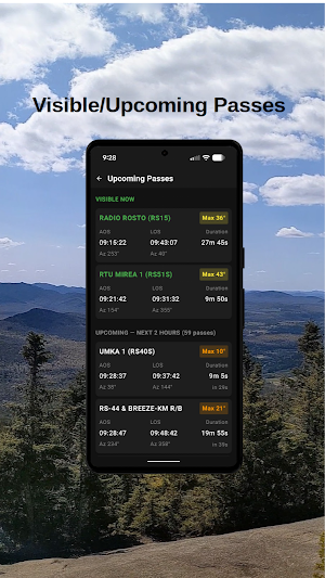
• Pass prediction table displaying satellites currently above the horizon and upcoming passes
• Detailed pass information including:
* Maximum elevation
* Pass duration
* AOS and LOS times
* AOS and LOS azimuths
* Time until next pass
• Dataset selection for different satellite categories
• GPS position and status monitoring
• Compass tape and pitch ladder overlays for accurate device alignment
• Pitch and roll indication
• Optional target bearing display
• Support for both degrees and mils
• Morse-code haptic feedback for cardinal directions
• Adjustable overlay opacity
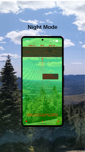
• Night Mode with optional low-light display enhancements
• Sensor calibration monitoring and orientation accuracy warnings
• Portrait and landscape orientation support
APPLICATIONS
OrbitAR Satellite Tracker can be used for:
• Amateur radio satellite operations
• Weather satellite observation
• Navigation satellite visualization
• Educational demonstrations of orbital motion
• Space station tracking
• General satellite awareness and observation
OrbitAR Satellite Tracker is designed for users who want a practical satellite tracking tool that combines real-time orbital calculations, augmented reality visualization, and device sensor integration in a single application.
What’s new
Version 24.0 · Updated August 12, 2026
Fixed satellite data loading in release builds
Alternatives to OrbitAR Satellite Tracker
Looking for apps like OrbitAR Satellite Tracker? Here are 6 similar Android apps on Google Play. All of them are free to download.
-
Fire Hydraulics
-
Military AR Compass
-
Fire Nozzle Flow
-
Fire Dynamics Calculator
-
Military GPS
-
Cups Grams Converter
| App | Rating | Price | Installs | Last updated | Compare |
|---|---|---|---|---|---|
| OrbitAR Satellite Tracker | – | Free | 100+ | Aug 12, 2026 | |
| Fire Hydraulics | – | Free | 500+ | Aug 31, 2026 | Compare |
| Military AR Compass | – | Free | 500+ | Apr 16, 2026 | Compare |
| Fire Nozzle Flow | – | Free | 50+ | Jul 23, 2026 | Compare |
| Fire Dynamics Calculator | – | Free | 100+ | Jul 23, 2026 | Compare |
| Military GPS | – | Free | 1,000+ | May 20, 2026 | Compare |
| Cups Grams Converter | – | Free | 500+ | Jul 24, 2026 | Compare |