
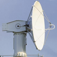
Weather & Radar India
RealWorld Weather In-app purchases Contains ads
India weather radar and satellite images
- Downloads
- 66.6K+
- on Google Play
- Price
- Free
- In-app purchases
- Updated
- Oct 5
- 2026 · v4.8
Screenshots


About Weather & Radar India
Key Features of Weather & Radar India app:
• India live Doppler weather radar Images.
• Indian Sector Satellite Images.
• Every 10 minutes radar image updated.
• 24 India city's Doppler Weather Radar Images.
• Change your desire city and see the clouds position.
• Insat 3D, Insat 3DR and Meteosat-8 Satellite Images.
Doppler Weather Radar Image Features:
• MAX(Z) => Maximum Display(Z) -This radar image gives the clouds position with cloud height within 250 KM range.
• PPZ500 => Plan Position Indicator(Z) -This radar image gives the clouds position within 500 KM range.
• PPZ150 => Plan Position Indicator(Z) -This radar image gives the clouds position within 150 KM range.
• PPV => Plan Position Indicator(Radial Velocity) -This radar image gives the clouds radial velocity within 250 KM range. The radial velocity towards radar site is taken as negative value (-ve) and away from radar site is taken as positive value (+ve).
• VVP2=> Volume Velocity Processing 2-This radar image gives the direction and radial speed of winds in different standard layer/height from surface.
• SRI – Surface Rainfall Intensity -This Image is an image of the rainfall intensity in a user selected surface layer within 100 KM range.
• PAC - Precipitation Accumulation -This Image shows the total rainfall amount in (mm) within 24 Hours. 250 KM range.
This App gives you the easy access and quick view of clouds over your city from Doppler weather radar images and satellite images published by India Meteorological Department.
User reviews

Very Good.
Improved now to being more accurate. Glad to use the satellite images, wish color image is possible in the future.

Useful app

Excellent application

excellent app

The biggest reason i like abt this app is that it shares the pictures as we see in IMD website unlike other apps. If it checks location automatcally and set location on that, it would be great.Also for each report we needs to change location manually.So if you could add that setting globally, it would be good too.An...
Frequently asked questions
What are the key features of the Weather & Radar India app?
The key features of the Weather & Radar India app include live Doppler weather radar images of India, Indian sector satellite images, radar image updates every 10 minutes, Doppler weather radar images of 24 Indian cities, the ability to change your desired city and view the clouds' position, and satellite images of Insat 3D, Insat 3DR, and Meteosat-8.
What information can be obtained from the Doppler Weather Radar Images?
The Doppler Weather Radar Images provide information such as the clouds' position with cloud height within a 250 KM range (MAX(Z)), clouds' position within a 500 KM range (PPZ500), clouds' position within a 150 KM range (PPZ150), clouds' radial velocity within a 250 KM range (PPV), direction and radial speed of winds in different standard layers/height from the surface (VVP2), surface rainfall intensity within a user-selected surface layer within a 100 KM range (SRI), and total rainfall amount in mm within 24 hours within a 250 KM range (PAC).
Alternatives to Weather & Radar India
Looking for apps like Weather & Radar India? Here are 4 similar Android apps on Google Play. The highest rated is Dew Point Humidity Calculator (3.0/5), and all 4 are free to download.
-
Live NOAA Satellite Weather
-
Dew Point Humidity Calculator 3.0
-
Live Himawari Satellite Image 3.0
-
Weather India
| App | Rating | Price | Installs | Last updated | Compare |
|---|---|---|---|---|---|
| Weather & Radar India | – | Free | 50,000+ | Oct 5, 2026 | |
| Live NOAA Satellite Weather | – | Free | 100+ | Nov 5, 2022 | Compare |
| Dew Point Humidity Calculator | 3.0 / 5 | Free | 10,000+ | – | Compare |
| Live Himawari Satellite Image | 3.0 / 5 | Free | 10,000+ | – | Compare |
| Weather India | – | Free | 10,000+ | Sep 16, 2026 | Compare |