About DipRota
DipRota is a planning application designed to help you assess fishing spots, sea conditions, and weather before heading out fishing.
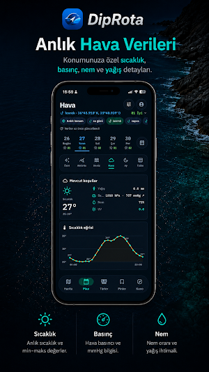
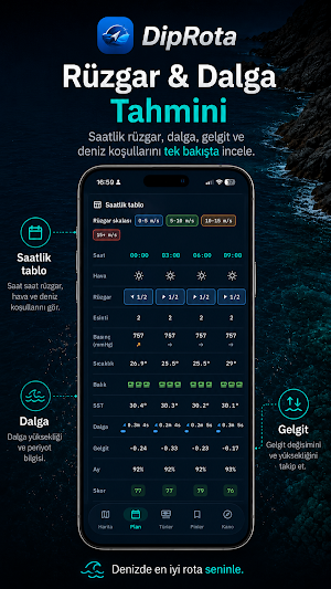
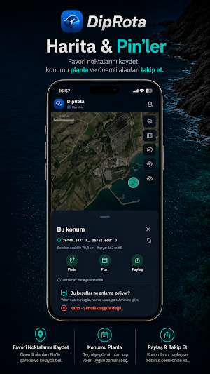
Select points on the map, save your own pins and fishing notes on the server, review previously shared fishing spots, and check daily forecasts before you go fishing. The planning screen gathers wind, pressure, temperature, moon phase, solunar hours, wave, and sea data in one place. Canoe mode displays essential on-site information such as live location, direction, speed, and anchor alarm in a quick-to-read format.
Key features:
- 10-day scrollable fishing plan
- Pin and point selection and depth/bottom layers on the map
- Wind, pressure, temperature, moon phase, and solunar decision support information
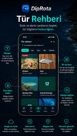
- Fish species guide and fish identification stream
- Live location, compass, speed, and anchor alarm for canoeing
- GPX/KML import support
DipRota forecasts are for decision support purposes only. Sea and weather conditions can change rapidly; for safety, also check official meteorological, maritime warnings, and local regulations.
Similar Apps

Guru Maps Pro & GPS Tracker
Get a map before your next journey and navigate with confidence even offline.

Avenza Maps: Offline Mapping
Offline maps & GPS navigation for trails, topography & surveying

Windfinder: Wind & Weather map
Wind forecast, reports, tides & waves for sailing, kite, surf, boating & outdoor

Nautide: Tides, Wind, Waves +
Plan and enjoy the activities at sea: surf, fishing, sailing, diving, kayak ...

Windy.app - Enhanced forecast
View weather widget and map. Wind direction and speed. Tides times and waves

OneSoil Scouting: Farming Tool
Monitor fields and crop growth. Identify problem areas and add notes
