KATNA: Metal detector and maps
Old & historic maps, GPS & AR navigation, compass, weather, pedometer
About KATNA: Metal detector and maps
A unique app for metal detecting enthusiasts and outdoor lovers. Old maps, LIDAR and historic military surveys on your phone. Plus a GPS finds catalog, AR navigation and field tools. KATNA is the complete kit for everyone who takes detecting seriously.
HISTORIC MAPS:
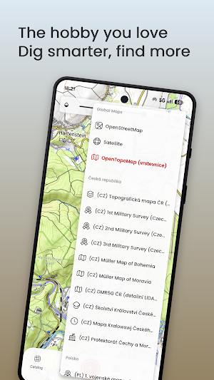
* 1st Military Survey (1763–1787)
* 2nd Military Survey (1836–1852)
* 3rd Military Survey (1876–1878)
* Müller's Map of Bohemia (1720) and Moravia (1716)
* LIDAR map of the Czech Republic – reveal lost paths, ramparts and hidden structures in the terrain
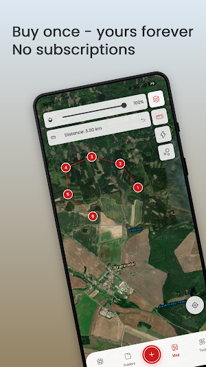
* High-quality satellite imagery
* Topographic hiking maps
GPS FINDS CATALOG:
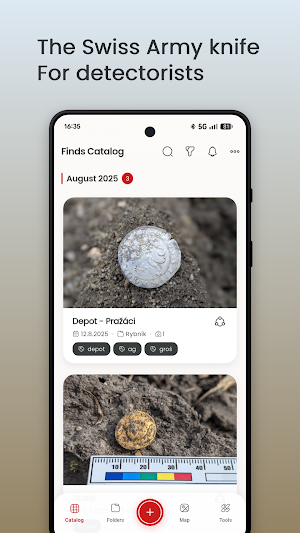
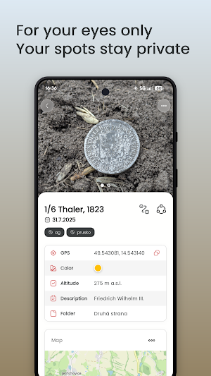
* Finds diary – photos, coordinates, notes, tags and folders
* Heat map of locations – see where you found the most
* AR navigation – augmented reality guides you back to the exact find spot
* Print find record cards for archaeologists and museums
* Data export and automatic backup to your Google Drive
FIELD TOOLS:
* Pedometer with minimal battery impact
* Compass for orientation
* Magnifier – examine coins and small finds, freeze frame, filters
* Weather – hourly outlook and 4-day forecast for planning your trips
WHY KATNA:
✓ Created by an active detectorist, field-tested
✓ NO SUBSCRIPTION – one-time purchase for full access
✓ Backed by the detecting community
Works with any metal detector brand – whether you use Minelab, Garrett, XP Deus or Nokta, this app is made for you. No pairing, no Bluetooth.
Similar Apps

Hervé Road Log
Track your trip and save events on the way.

E-Tap
Every EV charging station in Azerbaijan on a single map.

UbicateApp
Locate your bus with the Radar and pay your fare with QR code

Navigo
Catch your Wits campus bus on time, even with no signal. Fast, offline, simple.

Spritbiene
Fuel prices are lower. Fuel prices, EV charging stations & fuel prices in Austria.

지하섬 - 실시간 지하철 하차 알림
Meet Jihaseom, a subway notification app with a cute pixel art platform concept!
