
Lobsterly: Florida Lobster Map
Lobsterly Sports In-app purchases
3,000+ Florida lobstering & diving spots, reef maps, GPS waypoints & season info
- Downloads
- 249+
- on Google Play
- Price
- Free
- In-app purchases
- Updated
- Sep 26
- 2026 · v2.0.0
Screenshots
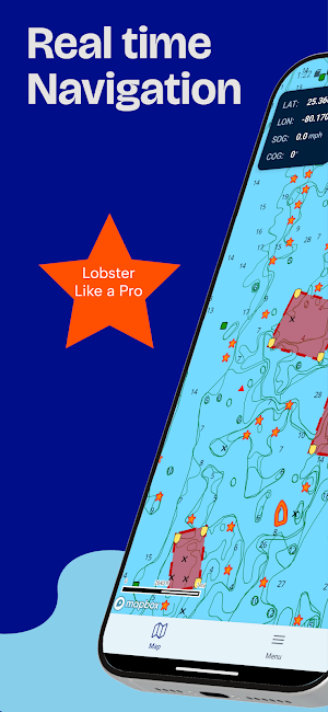
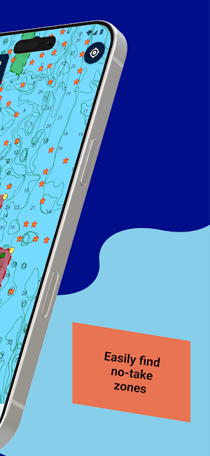
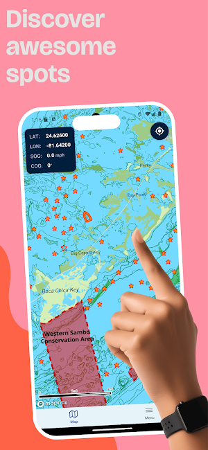
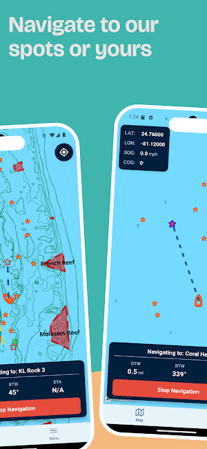

About Lobsterly: Florida Lobster Map
Built for lobster divers and snorkelers who want to spend less time searching and more time in the water. Open the map, pick a spot, and go. Works offline, so your spots and no-take zone maps stay with you even with no signal offshore.
WHAT YOU GET
• 3,000+ premium lobster GPS waypoints from Miami to Key West
• Around 100 free spots to try before you buy
• 4,500+ Florida public artificial reefs, mapped and searchable
• No-take zone maps so you always know where lobstering is closed
• Live heading, distance, and ETA to any waypoint
• Save favorites and add any spots you find to your private collection
• Trip logs and a pre-dive checklist
• Current Florida lobster regulations, bag limits, and season dates
• One-time purchase, no subscription
WHERE YOU CAN LOBSTER
Spots cover the whole chain, including:
• Miami, Key Biscayne, and Biscayne National Park
• Key Largo, Islamorada, and John Pennekamp
• Marathon, Duck Key, and the Seven Mile Bridge
• Big Pine, the Lower Keys, and Key West
UNLOCK BY REGION
Buy all of Florida or just the water you dive:
• Miami & Biscayne
• Upper Keys (Key Largo to Islamorada)
• Middle Keys (Marathon to Ramrod Key)
• Lower Keys (Ramrod Key to Key West)
DIVE, SNORKEL, OR SKIP THE BOAT
Lobsterly works for every style: scuba, freediving, and snorkeling on the reef, plus shallow spots you can reach by kayak, paddleboard, or from shore. Tickle stick and net, tail snare, or a bully net at night, you still have to find the bugs first. That is what the map is for.
LOBSTER SEASON
Florida's spiny lobster season has two parts. The two-day mini season runs the last consecutive Wednesday and Thursday of July, and the regular season runs August 6 through March 31. Lobsterly keeps the dates and limits in front of you so you dive legal.
Always confirm current rules with the FWC and local authorities. Follow all size, bag, and licensing requirements. A Florida saltwater fishing license and a lobster permit are required for most divers.
Download Lobsterly and find your next lobster spot.
What’s new
Version 2.0.0 · Updated September 26, 2026
Lobsterly 2.0 is our biggest update yet. • New high-resolution bathymetry chart with shaded reef, ledge & wall relief from NOAA survey data • 6 free ocean layers: SST, temp breaks, chlorophyll, altimetry, altimetry breaks & daily true color • Free official NOAA ENC charts for US waters • Weather, tides & NOAA forecasts • Improved waypoint navigation • Drift calculator & map ruler • iPad/tablet support • Waypoint notes, coordinate copying, map visibility controls & fixes
User reviews

have not been to the spots yet but the spots seem to show some structure on Google maps.
Alternatives to Lobsterly: Florida Lobster Map
Looking for apps like Lobsterly: Florida Lobster Map? Here are 2 similar Android apps on Google Play. The highest rated is Bully Bunches US (4.8/5), and all 2 are free to download.

| App | Rating | Price | Installs | Last updated | Compare |
|---|---|---|---|---|---|
| Lobsterly: Florida Lobster Map | – | Free | 100+ | Sep 26, 2026 | |
| Water Country USA | 4.2 / 5 | Free | 50,000+ | Oct 28, 2026 | Compare |
| Bully Bunches US | 4.8 / 5 | Free | 1,000+ | Oct 29, 2026 | Compare |