Field'O'Meter
Geological compass and inclinometer for logging strike, dip, and GPS field data
About Field'O'Meter
Here is the exact, professional Full Description tailored to the technical reality of the application. It is formatted for direct copy-pasting into the Google Play Console (up to 4000 characters).
Field'O'Meter is a specialized digital field diary engineered specifically to streamline the collection of structural geological data.
By utilizing your device's internal magnetometer and accelerometer, Field'O'Meter replaces the traditional compass, inclinometer, and paper notebook to provide a rapid, integrated workflow for field geologists and researchers.
The Measurement Workflow:
The interface enforces a strict, logical sequence to ensure accurate data capture in the field:
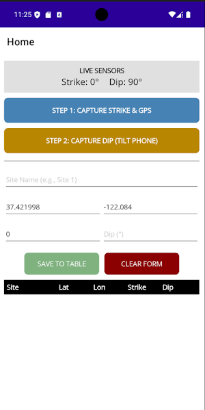
Capture Strike & GPS: Records the azimuth using the device compass alongside the precise latitude and longitude coordinates.
Capture Dip: Once the strike is secured, reposition the device against the rock plane to record the dip angle via the accelerometer.
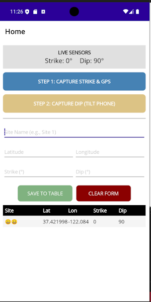
Log & Edit: Data is pushed to an editable staging area where coordinates, site names, and angles can be manually adjusted before being committed to the database.
Core Features:
Live Sensor Telemetry: Real-time readouts for Strike (azimuth) and Dip (angle).
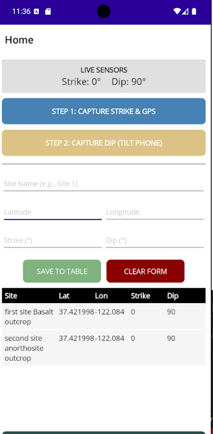
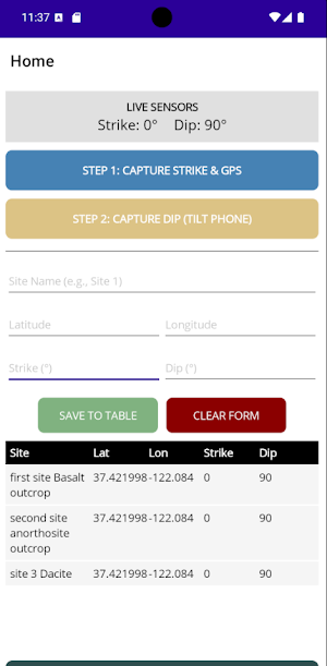
Persistent Local Storage: All recorded sites are saved directly to the device's internal storage. The data persists even if the app is closed, acting as a reliable digital ledger.
Offline Functionality: Data collection and storage function entirely offline, vital for remote field sites with no cellular reception (GPS acquisition time may vary without A-GPS).
Universal Export: Export the entire measurement table directly to a Comma Separated Values (CSV) file.
Analysis Integration:
Field'O'Meter is designed to bridge the gap between physical fieldwork and computational analysis. The standardized CSV output eliminates manual data entry errors and is formatted for immediate integration into GIS platforms (QGIS, ArcGIS) or Python dataframes. This makes it an optimal tool for gathering ground-truth structural data required for complex spatial modeling, including Landslide Susceptibility Mapping (LSM) architectures.
Data Privacy:
This application requires Location (GPS) permissions strictly to record the coordinates of your field sites. All data remains stored locally on your physical device and is never transmitted to external servers. Data is only exported when explicitly triggered by the user.
Similar Apps

Fortune Gems
Simulate flight paths and analyze the physics in Fortune Gems

Maanyan Dictionary
A simple Dayak Maanyan Dictionary

AbraMed
Educational platform

Odysseya
For the curious traveler: old stories, fascinating places, good meals.

Klein Vaarbewijs 2 Examen
Practice for Small Boating License 2 Exam: questions, practice exams, and explanations, offline.

Lunyb
Protect your privacy, block trackers, and shorten links securely with Lunyba.
