

EDDMapS Ontario
Bugwood Tools
EDDMapS Ontario brings the power of EDDMapS to your Android phone
- Downloads
- 1K+
- on Google Play
- Price
- Free
- No in-app purchases
- Updated
- Sep 3
- 2019 · v4.2.2_3
Screenshots
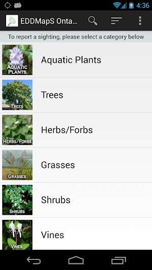
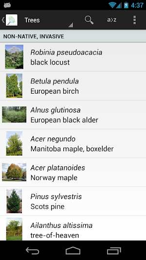
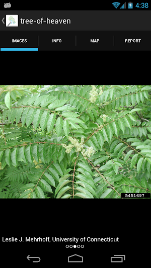
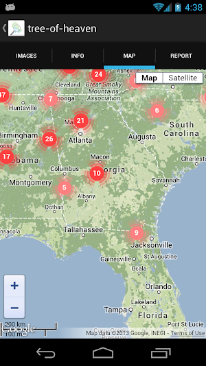


About EDDMapS Ontario
EDDMapS Ontario brings the power of EDDMapS to your Android phone. Now you can submit invasive species observations directly with your Android phone from the field. These reports are uploaded to EDDMapS and e-mailed directly to local and state verifiers for review. EDDMapS Ontario was developed by the University of Georgia Center for Invasive Species and Ecosystem Health.
App developed by Rustico David, Jr. and Chuck Bargeron, University of Georgia – Center for Invasive Species and Ecosystem Health.
EDDMapS Ontario was developed through the support and funding provided by the Canada/Ontario Invasive Species Centre, the Ontario Federation of Anglers and Hunters, and the Ontario Ministry of Natural Resources.
Features:
Easy species reporting that captures your current location and allows you to submit an image of your sightings. EDDMapS Ontario allows for both online and offline reporting with reports saved on your phone for uploading when you have network connectivity.
Images and information on Ontario\'s worst non-native invasive animals and plants.
Real-time point distribution maps centered on your current location.
Powered by EDDMapS - The University of Georgia Center for Invasive Species and Ecosystem Health\'s Early Detection and Distribution Mapping System. EDDMapS allows for real time tracking of invasive species occurrences using local and national distribution maps and electronic early detection reporting tools.
For more information about EDDMapS,
visit http://www.eddmaps.org/.
What’s new
Version 4.2.2_3 · Updated September 3, 2019
New species added.
Alternatives to EDDMapS Ontario
Looking for apps like EDDMapS Ontario? Here are 5 similar Android apps on Google Play. The highest rated is PTCB & PTCE Exam Prep 2023 (4.8/5), and all 5 are free to download.
-
Aceable Defensive Driving 4.5
-
Travefy Pro 4.2
-
Visibook appointment scheduler 3.4
-
PTCB & PTCE Exam Prep 2023 4.8
-
Agendrix 4.6
| App | Rating | Price | Installs | Last updated | Compare |
|---|---|---|---|---|---|
| EDDMapS Ontario | – | Free | 1,000+ | Sep 3, 2019 | |
| Aceable Defensive Driving | 4.5 / 5 | Free | 10,000+ | Sep 28, 2026 | Compare |
| Travefy Pro | 4.2 / 5 | Free | 10,000+ | – | Compare |
| Visibook appointment scheduler | 3.4 / 5 | Free | 50,000+ | Feb 21, 2024 | Compare |
| PTCB & PTCE Exam Prep 2023 | 4.8 / 5 | Free | 10,000+ | – | Compare |
| Agendrix | 4.6 / 5 | Free | 100,000+ | Sep 11, 2026 | Compare |
Compare EDDMapS Ontario with the top alternatives: ratings, updates, ASO score and keyword gaps →