About OilTrails
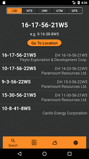
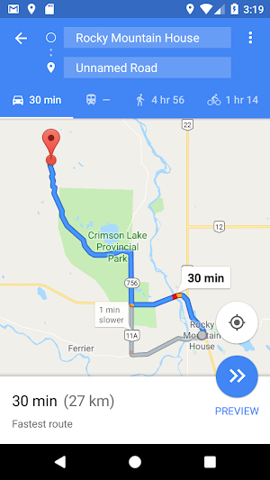
The navigation app made specifically for the Canadian oilfield. Get turn-by-turn navigation to lease* or just see where it is. Just enter the location number and you are set. No more fumbling around with confusing directions. This location finder will provide detailed directions to lease.
Features:
-Compatible with LSD coordinates in Alberta and Saskatchewan
-Compatible with NTS coordinates for BC locations
-Also supports UWI, UTM, and Lat/Lng coordinates
-Keeps history of previous searched for locations to access even quicker
-Simple yet powerful, see where your lease is in seconds
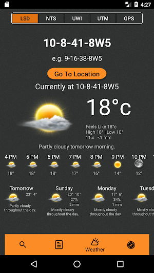
-Lease specific weather
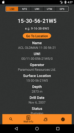
-Well data
*Turn by turn navigation to lease is compliant on mapping data in Google's navigation system. Some roads (like some lease roads, new, or very remote ones) will not be in the locator mapping system and therefore the app will only be able to bring you to the closest road point with turn by turn navigation. Oil Trails will ensure easy navigation in the Canadian oil field.
Similar Apps
Tubing Stretch
Made specifically for oilfield applications. Easily figure out amount of stretch needed...

Hole Volumes
-Made specifically for service rig or oilfield operations.-Easily figure out hole volumes...

Canadian Oilfield LSD Locator
The navigation app made specifically for the Canadian oilfield. Get turn-by-turn navigation...
Frequently Asked Questions (FAQ)
What is OilTrails?
What coordinates does OilTrails support?
Can I access previously searched locations on OilTrails?
Does OilTrails provide weather information for lease locations?
What other features does OilTrails have?
Are there any limitations to the turn-by-turn navigation feature?


