Aerial Fence
Drone-powered livestock monitoring, patrol automation & smart ranch security.

About Aerial Fence
Aerial Fence is a powerful, drone-integrated ranch management app designed for livestock monitoring, land supervision, and automated patrols. Whether you manage a small pasture or hundreds of acres, Aerial Fence provides real-time visibility, precision tracking, and smart AI assistance to help you protect and optimize your ranch operations. From monitoring animal movement to reviewing aerial missions, Aerial Fence gives ranchers complete control over their land — all from the sky.
Key Features
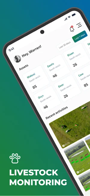
Real-Time Livestock Monitoring
Track your cattle, goats, horses, or any other animals with satellite-grade precision.
Monitor herd movement, activity levels, and location history in real time.
Receive instant alerts when animals move outside predefined zones or exhibit unusual behavior.
Mission Logs & Drone Patrols
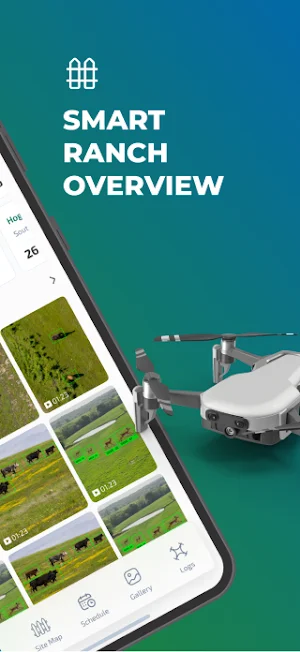
Plan and automate drone patrols over your property.
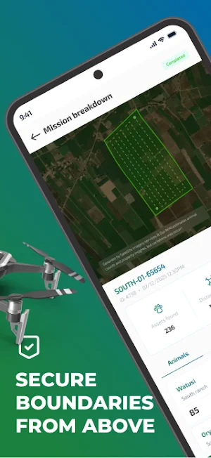
Record, review, and analyze drone missions to ensure your ranch is secure.
Access aerial footage, flight paths, and activity logs anytime for a complete overview of past missions.
Comprehensive Asset Overview Dashboards
Visualize your entire ranch at a glance.
See all assets, livestock, pastures, and activity zones in one intuitive dashboard.
Use heatmaps and activity reports to identify patterns and optimize land use.
Geofence Alerts
Set up virtual boundaries around pastures or restricted areas.
Get instant notifications whenever animals breach these boundaries or enter specific zones.
Protect your livestock and assets from wandering, theft, or predator risks.
AFAI Smart Assistant
Leverage the AI-powered chat assistant to simplify ranch management.
Ask questions about livestock or drone patrols
Generate detailed reports on animal activity and land usage
View flight history and aerial mission summaries
Schedule automated drone patrols and receive proactive recommendations
Detailed Animal Activity Reports
Gain insights into your livestock’s daily behavior:
Grazing and resting patterns
Movement history
Risk zone detection
Heatmaps of activity for better resource allocation
Precision and Safety From the Sky
Aerial Fence combines cutting-edge drone technology, GPS tracking, AI analytics, and GIS mapping to give you the most accurate picture of your ranch.
Enhance security, reduce manual labor, and make data-driven decisions to improve livestock management and land utilization.
Perfect for All Ranch Sizes
Whether managing a single pasture or vast ranchland, Aerial Fence scales to your needs:
Small-scale livestock farms
Medium ranches
Large commercial operations
Wildlife or conservation monitoring
Why Choose Aerial Fence?
Automates livestock tracking and land monitoring
Reduces manual inspection and patrol time
Enhances security and asset management
Provides actionable insights for better herd management
Easy-to-use interface designed for ranchers, farmers, and land managers
Take control of your ranch with Aerial Fence.
Monitor livestock, manage drone patrols, set geofences, generate activity reports, and receive AI-driven insights — all from a single, integrated platform. Automate tasks, improve safety, and optimize your ranch operations with the power of drones and AI.
Download Aerial Fence today and start monitoring your ranch smarter, safer, and faster!
Similar Apps
BatiQuant
Site calculations, measurements, estimates and project monitoring.

Konnect GPS
Asset Management

Dash Express
Dash Express is the company that provide the Delivery Service in Cambodia.

Assurance Cianciulli
Access your client portal 24/7!

Ravzora Analytics App
Manage and monitor all your outlet performences at single place
Cervo Menu Admin
Manage restaurant menus, orders, and products in real time.
