About Estrada Real
The Estrada Real App is a complete and indispensable guide for those who are going to visit the largest tourist route in Brazil, in its more than 1,630 kilometers of extension, passing through Minas Gerais, Rio de Janeiro and São Paulo. In it, the tourist finds historical and natural attractions, lodgings and restaurants of the cities that integrate the tourist destination. You can get to know the places you are going to visit and plan your trip safely and then experience the beauties and flavors of the Estrada Real.
In the Estrada Real app you will have access to:
* Georeferencing of the exclusive map of Estrada Real;
* Information from the municipalities;
* Calendar of events and parties on Estrada Real
* Service chain information (Where to stay, where to eat, where to go);
* Estrada Real virtual passport (Check in at specific points - Gamification);
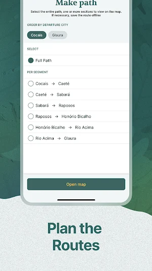
* Access to landmark mapping (Planned Routes, Altimetry, GPS);
* Access to the Estrada Real Gastronomic Route;
* Space for disclosure of partners;
* Platform of relationship with the tourist vs community vs partners;
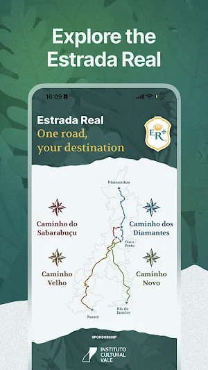
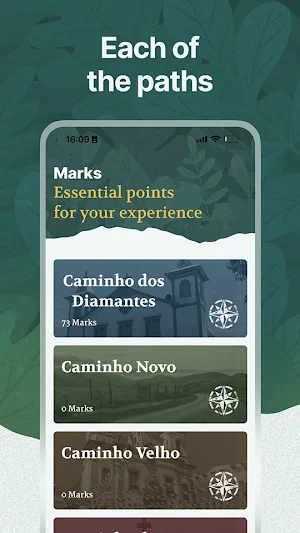
The Estrada Real is formed by four paths. Officially opened by the Portuguese Crown, these paths connect the old regions of mines and precious stones, in the interior of the state of Minas Gerais, to the coast of Rio de Janeiro, also passing through São Paulo.
* Old Way: From the sea to the mines, it totals 630 kilometers. Leaving Paraty, on the coast of Rio de Janeiro, it passes through the Serra da Mantiqueira, the Water Circuit, through old villages transformed into medium-sized cities with great tourist potential. The final stop is Ouro Preto, central point of Estrada Real.
* New Path: The 515 kilometers of the New Path are the youngest on the Estrada Real. Its creation took place in 1698, but it was between 1722 and 1725 that the route was finally defined. From Ouro Preto to Rio de Janeiro, it connects Minas Gerais to the sea in the capital of Rio de Janeiro. Today, full of tourist attractions, it keeps dozens of traces from the mining era, a true invitation for the traveler.
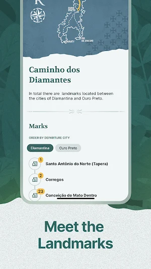
* Path of Diamonds: The Path of Diamonds is about 350 kilometers long and connects Diamantina to Ouro Preto. It became of great importance from 1729, when the precious stones of Diamantina gained prominence in the Brazilian and Portuguese economies.
* Sabarabuçu Path: The Sabarabuçu Path was created as an alternative route between the Diamond Path and the city of Ouro Preto. Its 160 kilometers connect the districts of Cocais (Barão de Cocais) and Glaura (Ouro Preto). The short distance is enough to host places with a lot of history to tell.
Download the app and discover the wonders of Estrada Real!
Similar Apps

AlviDrive Conductor
Tired of being at your stops without generating cash, wasting fuel

WaaJee Cab
WaaJee Cab - is a Taxi booking application for passengers.

Iberojet
Iberojet - It's all about flying
匯豐協新租車
HSBC Xiexin Car Rental has more than 60 car rental bases in Taiwan. It is the most convenient to pick up/return the car. It belongs to the affiliated company of HSBC Automobile Group.

WaaJee Cab Drivers
WaaJee Cab - Driver App is Taxi booking application for driver.

Felow - فيلو
Felow assists people in finding their way to everything related to education
Frequently Asked Questions (FAQ)
