Satellite Scanner: GPS & Stars
Track GPS/GNSS satellites, stars, altitude and speed on a live sky map

About Satellite Scanner: GPS & Stars
Turn your phone into a live sky map for GPS/GNSS satellites, stars, altitude and speed.
GPS/GNSS Satellites & Stars shows what is above you right now — and what your own phone can actually detect. Point your phone at the sky to find satellites and stars, explore your position data, and see how your device builds its location fix in real time.
See the satellites your phone can use:
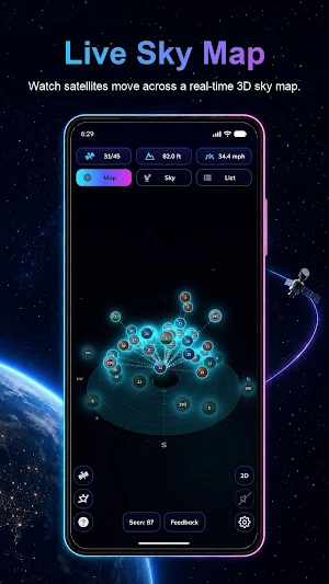
View GPS, Galileo, GLONASS, BeiDou, QZSS and NavIC satellites when supported by your device. Satellites are placed in the sky so you can see where they are above you and whether each satellite is currently being used to calculate your location fix.
Live fix visualization:
The app makes GNSS positioning easy to understand. In the 3D and 2D sky views, satellites used in the current fix are highlighted visually per satellite, so you can instantly see which signals are helping determine your position. When a satellite disappears from view, it leaves the sky with a smooth animation. You can even change the exit animation in settings.
Stars, Sun and Moon:
Aim your phone upward and explore the night sky. Search and view stars from a built-in database of over 8,000 stars, plus the Sun and the Moon. Open any object to see rich astronomical details and better understand what you are looking at.
Detailed satellite information:
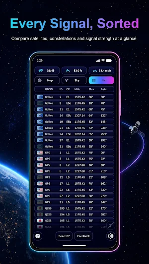
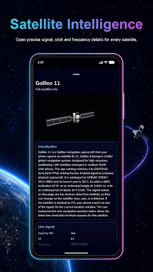
Open a satellite to inspect the data your device reports for it, such as constellation, satellite ID, elevation, azimuth, carrier frequency, almanac and ephemeris status, and fix usage when available. Availability depends on your device, Android version and supported GNSS constellations.
Altitude, speed and accuracy:
Follow your altitude above sea level with a history graph based on satellite positioning data. Check your current speed in km/h and view your location accuracy in a clear visual form, so you know how reliable your current position is.
3D, 2D and list views:
Rotate and zoom an interactive 3D map of the satellite constellation, switch to a clean 2D view, or use the detailed list view to compare satellites and their most important data at a glance.
Satellite history log:
The app keeps a record of satellites found in the sky. Open the log view to explore detected satellites over time and see how the satellite environment around you changes.
Customize your sky:
Choose your language, adjust the color theme, change how satellite data and fix usage are visualized, choose the satellite exit animation, and control how many stars are shown in the sky view.
Use it for travel, hiking, sailing, driving, testing your phone’s GPS, learning GNSS, exploring the night sky, or simply understanding the invisible signals above you.
GPS/GNSS Satellites & Stars combines a satellite sky map, star finder, altitude tracker, speedometer, accuracy monitor, 3D/2D constellation viewer and satellite history log in one app.
Developed by Unelma Studios:
Website: https://unel.ma
Privacy Policy: https://unel.ma/privacy
Similar Apps

DBDD: Pet Tracker & Assistant
Pet GPS Tracker, Pet Assistant and Pet Community.

Genomapp: Raw DNA Analysis
Interpret 23andMe & AncestryDNA data for health reports and genetic traits

Valamar
Experience the ultimate holiday upgrade with Valamar mobile application.

Guru Maps Pro & GPS Tracker
Get a map before your next journey and navigate with confidence even offline.

Ham Radio Prep
Study for your Ham Radio License with video lessons, practice tests and quizzes.

Plant Identifier: LeafSnap
Identify Plants, Flowers, Trees & Mushrooms. Plant Care, Disease Diagnosis App