


Hike, bike, walk, or run, map routes & discover the great outdoors safely
Discover the great outdoors with Great Britain’s most popular leisure mapping app and explore your way with OS Maps. Walk, hike, ramble, bike or even run across stunning paths throughout the Great British countryside and find the route that’s right for you.
Looking to stick to local paths? Or do you want to venture off the beaten track? Discover Great Britain and all of the exhilarating cycling and hiking routes it has to offer. Enjoy the fresh air, listen to the crunch of leaves under your feet and experience the enjoyment of finding a brand new route that you never even knew existed. Hike, bike, ramble, run and enjoy every inch of Great Britain and its scenic countryside.
From the beach to the countryside, explore the great outdoors the way you want and do it all while staying safe.
Walk, hike, bike, ramble, horse ride and more - why you’ll love using OS Maps:
• UNMISTAKABLE OS MAPPING
Subscribe to unlock the detail and accuracy of OS leisure maps across the whole country including OS Explorer 1: 25,000 and OS Landranger 1:50,000 maps.
• DISCOVER THOUSANDS OF MAP ROUTES AT YOUR FINGERTIPS
Discover the great outdoors and search for the best cycling and hiking routes in your area as rated by fellow outdoor enthusiasts and plot your own route to follow, share or record.
• AWARD-WINNING MAP TECHNOLOGY
OS Maps was voted Yahoo Sports Technology Awards Best App, Outdoor Industry Awards Digital Product of the Year and Singletrack Best Online Service.
• MAP ROUTES ON EVERY DEVICE
View, create and sync your activities between desktop and mobile. On a desktop, premium users can use our 3D Aerial Layer to plan a route, see the terrain, explore in stunning 3D with route fly-throughs and print maps.
Want to explore the great outdoors even more? From additional hiking routes to Augmented Reality our premium subscription gives you access to many other exciting features.
• PREMIUM FEATURES
Enjoy authored routes from BBC Countryfile, Country Walking, Mountain Bike UK, Trail Running Magazine, AA Walks and more.
• NATIONAL PARK TRAILS
Use OS Maps as your off-road sat nav with automatic ‘snap-to-path’ giving you the most enjoyable and safe route between two points in National Parks.
• VIEW MAPS OFFLINE
Download your favourite areas to view offline – so you can view any part of Great Britain even without signal. Plus, you can export your favourite walking routes to your GPX device.
• UNLIMITED PRINTING
Print a copy of your custom routes and maps to take with you so you always have a backup
• 3D MAPPING AND FLYTHROUGHS
Explore anywhere in Britain with the Aerial 3D layer. Fly-through a route to get a good understanding of the terrain, find the best viewpoints and discover nearby points of interest.
• AUGMENTED REALITY
Pan the landscape to see what’s nearby including hills and mountains, forest and woodland, transport, settlements, coast and water. And, with one click, find local area information with routes, places to stay and local images.
• USEFUL INFORMATION
Battery life can be dramatically decreased by using GPS constantly.
We release updates to all of our apps as we improve them, making them even more stable and adding extra features. Along the way, your feedback and comments about those apps are really important to us. If there’s something you’d like us to know, please tell at [email protected]
Discover hiking routes, rambling routes, cycling paths and so much more with the app that lets you explore the joy of the Great British countryside. Whether you want to hike, bike or walk - discover thousands of exciting map routes today!
Trace a map with your finger and Footpath will snap to roads...
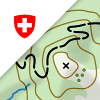
On the road with the best app of the year: the swisstopo...

Whether you're just starting your fitness journey or are a seasoned runner,...

Outdoor Tracking & Tours AppThe perfect ALL-IN-ONE tool for all your outdoor...

FATMAP is the #1 app for mountain sports.Explore the mountains with confidence...

Turn your next ride, hike, or run into an adventure with Komoot....
Frequently Asked Questions(FAQ)


Created with AppPage.net
Similar Apps - visible in preview.