About ZYRNTOPO
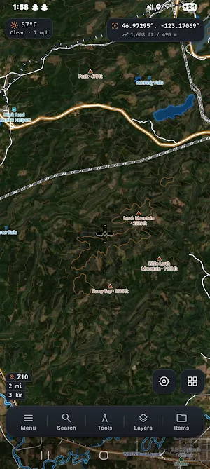
ZYRN TOPO is a topographic mapping app for hikers, hunters, field crews, and search & rescue teams who need reliable maps when working beyond cell coverage.
MAPS & LAYERS
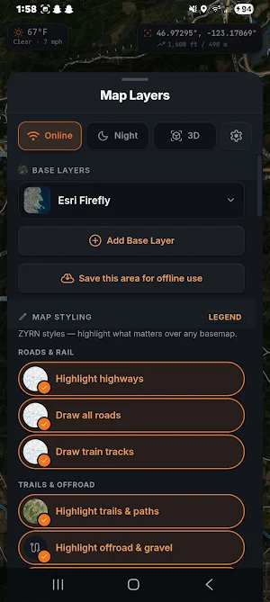
16 base layers span topo, imagery, street, and vector categories: USGS Topo, USGS Imagery + Topo, OpenTopoMap, NatGeo World, Esri World Topo, USA Topo (Historical), Esri World Physical, Esri Satellite, USGS
Imagery, Esri Ocean Basemap, OpenStreetMap, CartoDB Voyager, CartoDB Positron, CartoDB Dark, Esri Streets, Esri Light Gray, OSM Humanitarian, CyclOSM, Wikimedia Maps, OpenStreetMap DE, and three OpenFreeMap
vector layers (Liberty, Bright, Positron) rendered via MapLibre GL.
14 overlays stack on top of any base: Hillshade, USGS Topo, USGS Hydrography, Boundaries, Transportation, Hiking Trails, Cycling Routes, MTB Trails, OpenSnowMap Pistes, OpenSeaMap, OpenRailwayMap, OpenInfraMap
Power, BLM Public Lands, and Esri Reference Labels. Each overlay has an independent opacity slider.
Browse 1,345+ worldwide imagery sources from the OSM Editor Layer Index, filterable by country and type. Add any source with one tap. Custom WMS, WMTS, and WFS tile services can also be added manually.
3D TERRAIN
Real DEM elevation from Mapterhorn tiles, rendered by MapLibre GL. Control pitch, rotation, and zoom. Save a terrain area as a local PMTiles archive so 3D rendering continues to work without a network
connection after saving.
GPS & NAVIGATION
Real-time GPS with accuracy circle. Three-state centering: off, follow, and heading-up. Record tracks with live distance, elapsed time, and speed. Navigate to any marker with live bearing and distance. Tap any
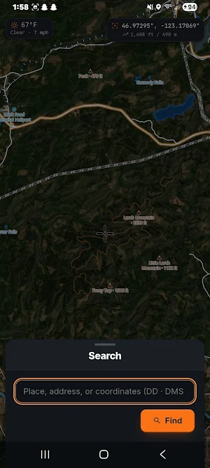
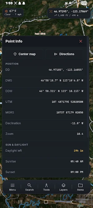
location for elevation data and NWS weather forecasts. Display and copy coordinates in DD, DMS, DDM, UTM, or MGRS. Search by place name or coordinates via Nominatim.
MAP OBJECTS
Drop markers at any location or current GPS position. Set name, notes, color, and icon — 50+ pin types available. Attach photos from the device camera. Draw lines and polygons by tap or freehand. Add buffer
zones, range rings, and sector shapes. Organize into folders with independent visibility. Assign objects to operational periods and filter by period.
TOOLS
Measure distance, polygon area, bearing, and elevation profile. Full color picker for all objects. Night mode with three intensity levels. Print the map view to PDF.
OPERATIONAL PERIODS
Create named periods with custom colors and line weights. Assign objects to periods and toggle per-period visibility — designed for structured multi-phase field and SAR operations.
TEAM & GEAR
Manage a team roster with names, roles, and contact info. Track a full gear inventory with per-item weight and category. Export and import both as CSV or JSON.
TILE STORAGE
Save map areas as .pmtiles files written to the Origin Private File System on your device. Supports multi-gigabyte archives with SHA-1 deduplication and live progress tracking. Raster and vector archives both
supported. A storage panel shows bounds, zoom range, and disk usage for each archive, with individual delete controls.
TEAM SYNC
Coordinate across five independent transports:
— WebRTC P2P: connect via a shared session code with no server required
— LAN WebSocket: local network sync with no internet access needed
— MAVLink: live drone position, altitude, battery, and flight mode on map
DATA IMPORT & EXPORT
Export as GeoJSON, GPX 1.1, KML/KMZ, or CSV. Import GeoJSON, KML/KMZ, GPX, and CSV. Print to PDF.
Similar Apps

BaseMap: 3D Hunting Maps & GPS
3D Maps, Offline 3D, Location Sharing, Public & Private land, weather, wind, GPS

Sea Trials - USCG License Exam
Upgrade USCG License

MAPS.ME: Offline maps GPS Nav
Worldwide offline navigation with maps and driving directions
Footpath Route Planner
Running, Hiking, Bike Map - Draw routes with your finger and navigate with GPS
TomTom - Maps & Traffic
Formerly AmiGO - Now TomTom

TrekSpots | Tent camping map
Find 300k campsites, wild camping & huts. Import GPX routes for hiking & biking!