About iPhiGéNie
iPhiGéNie is the tool of choice for mapping in France.
There are GPS applications with French maps inside, iPhiGéNie brings you ALL French maps from the National Geographic Institute, with a GPS inside.
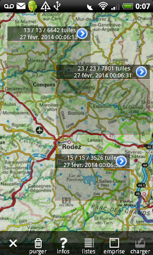
iPhiGéNie displays topographic maps, ortophotos, street and cadastral maps from the Geoportail. On this reference background your precise position (GPS + phone and wifi interpolation) is shown. Every map displayed once is kept in the device and is available even with no network (off-line mode). All non-topographic maps and most ortophotos stay permanently free.
NEW : since 2017-April-1 the provisional cache licence is included in the IGN annual basic licence.
NEW: FREE world-wide coverage though OpenStreetMap/openCycleMap, Spain, Germany, Italy, Norwey, IGN-littoral, and others new maps from IGN.
With V6, your IGN account is synchronized with IphiGéNie, and a new transparent layer "slope > 30°" is available.
IMPORTANT: Geoportail map service and resources are tied to a personal subscription, recurring by default. See conditions below. The application installation is free and comes with 7 calendar days of free access to the service. Optional Amax module adds extended features but do not include map subscription.
In App Purchases:
Amax option: This optional module, available through In App Purchase, add following features:
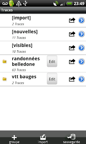
• Waypoints management, with photos: Add, file, annotate, export-import in GPX file format.
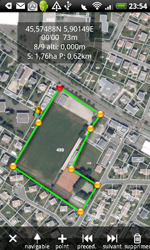
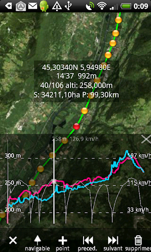
• Tracks and route: Recording, manual creation and editing, following, export-import in GPX file format.
• Automatic downloading of maps along a predefined track.
• Search address or any toponym present on a map. Automatic creation of relevant waypoint.
• "GPS beacon" feature: People you authorize, can follow your position on a detailed map, either on support web site on inside the application. No tracking is done unless you activate it.
• Follow you friends beacon: Automatic update of followed positions. Very handful to find each other in the middle of nowhere or see how far are your fellows.
Notes:
• GPS "beacon": Warning, given the phone network nature et battery capacity, you should never engage security on the availability of this feature.
• GPS and battery lasting: the GPS is shut down when the application is sent to background, if there is no activated function requiring it (track recording, "GPS beacon"). Continued use of GPS running in the background can dramatically decrease battery lasting.
• While there is no English translation of the manual yet, English speaking users are more than welcome to ask any question in the English section of the forum on the support web site.
• Recurring subscriptions to Geoportail map service
- Yearly subscription.
- Payment will be charged to Google Account at confirmation of purchase
- Subscription automatically renews unless auto-renew is turned off at least 24-hours before the end of the current period
- Account will be charged for renewal within 24-hours prior to the end of the current period.
- Subscriptions may be managed and auto-renewal may be turned off by going to the user’s Account Settings after purchase.
- No cancellation of the current subscription is allowed during active subscription period
- Any unused portion of the free trial period, will be forfeited when the user purchases a subscription to Geoportail map service.
iPhiGéNie details
iPhiGéNie is a free Travel & Local app for Android with 500,000+ installs on Google Play and a 3.8/5 average rating from 2,419 ratings. It was released on February 26, 2013 and last updated on June 19, 2020. It's developed by iPhiGéNie-Optima. It requires Android 4.1 or later. The app offers in-app purchases.
- Category
- Travel & Local
- Rating
- 3.8 / 5 (2,419 ratings)
- Installs
- 500,000+
- Price
- Free
- In-app purchases
- Yes
- Ads
- No ads
- Current version
- 9.3.4
- Size
- 13M
- Requires Android
- 4.1 and up
- Content rating
- Everyone
- Released
- February 26, 2013
- Last updated
- June 19, 2020
- Developer
- iPhiGéNie-Optima
What’s new in iPhiGéNie
9.3.3, 9.3.4 Bug authorization battery fixed (Android <= 6) Bug compas fixed New parameter to fix map screen orientation 9.3.0, 9.3.1, 9.3.2 Tracks dialog bug fixed Check consistency bug fixed Export GPX bug fixed Barometric altimeter added Import/export tracks and waypoints released Color attribut added to waypoint and tracks groups 9.2.0, 9.2.1 Swisstopo maps subscription available 3D controls extension bugs fixed
Version 9.3.4 · Updated June 19, 2020
Similar Apps

SwitzerlandMobility
The free SwitzerlandMobility app is the perfect app for anybody who is...

Footpath Route Planner - Runni
Trace a map with your finger and Footpath will snap to roads...

Mapstr
With Mapstr you can build the map of your own world: save...

swisstopo
On the road with the best app of the year: the swisstopo...
BackCountry Navigator XE: Topo
Download and use topo maps offline to explore the outdoors using your...

Guru Maps Pro
Detailed offline maps with turn-by-turn navigation for the great outdoors: hiking, biking...


