NearestSpot
Find interesting places nearby. Swipe cards, save favorites, and build routes.
About NearestSpot
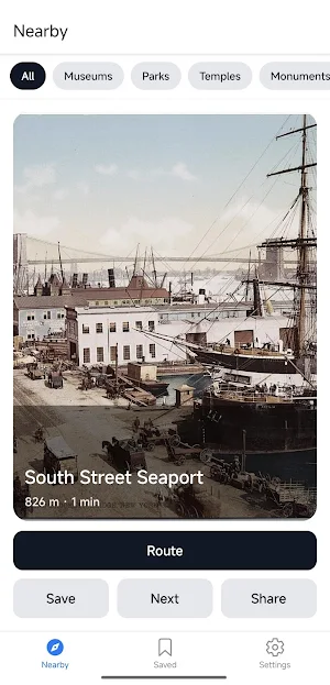
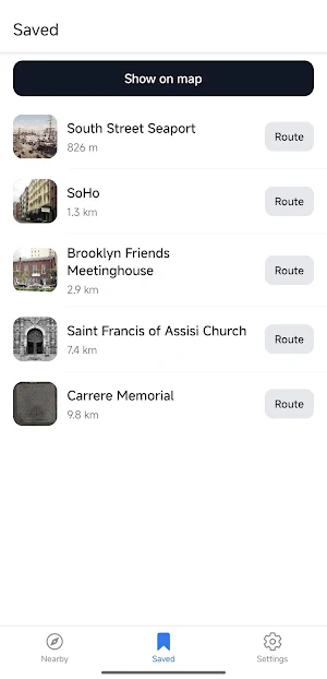
NearestSpot helps you find interesting locations around you using a card-swiping interface. Swipe right to save a place, swipe left to skip. Build routes directly from your saved list.
Data Sources
The app uses a cascading search system to ensure you always find points of interest. It pulls data from Google Places, Amap (for China), Wikipedia GeoSearch, and OpenStreetMap. If the primary source returns no results, the app automatically switches to the next one.
Smart Filtering
The algorithm automatically filters out mundane and transit locations. You will not see subway stations, bus stops, parking lots, gas stations, ATMs, retail stores, or residential buildings in your feed. Only actual points of interest are displayed.
Regional Adaptation
The app detects your current region via coordinates and adapts its behavior. It prioritizes Yandex Maps in Russia, Amap and Baidu in China, and Google Maps globally.
Image Search
Every place goes through a four-step image search cascade (Baidu Baike, Wikipedia, Wikimedia Commons, Openverse) to ensure cards are rarely empty, even for obscure locations.
Large Area Search
Supports search radii up to 500 km. For areas larger than 10 km, the app automatically breaks the search into a grid of sub-queries to cover the entire requested zone without hitting API limits.
Navigation
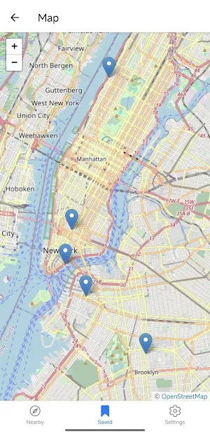
Build a route with one tap. The app offers a choice of navigators based on your region: Google Maps, Yandex Maps, Amap, or Baidu Maps.
Key Features
Search radius from 1 to 500 km.
Walking and driving travel modes.
Filter to show only places with photos.
Local data storage for saved places.
Support for custom API keys (Google Places, Amap).
Interface available in English, Russian, and Chinese.
Requirements
Android 8.0 and higher, location permissions, and an internet connection. The app contains no ads and no in-app purchases.
Similar Apps

My Track
Plan a route, record, share and follow. Photos can be joined and shared.

Multi-Stop Route Planner
Save time - take a shorter route

OsmAnd — Maps & GPS Offline
Navigation on hikes is no longer a problem. Download the map, put notes and go!

TfL Go: Plan, Pay, Travel
TfL's official transport app

HERE WeGo: Maps & Navigation
Enjoy the journey

SmartGuide: Digital Tour Guide
SmartGuide is your personal audio guide to the world, just inside your phone.
