Sentinella del fuoco
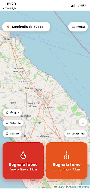
Report smoke: The community locates the fire and alerts those in danger.
About Sentinella del fuoco
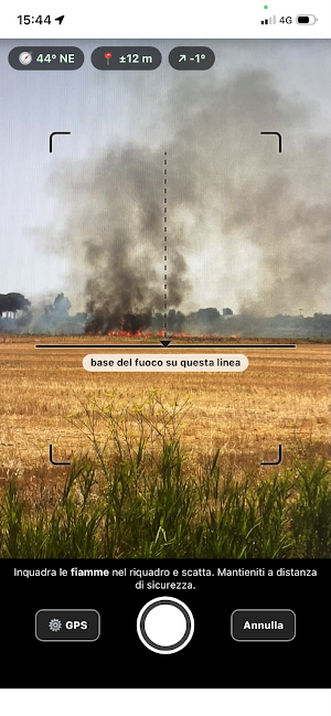
Do you see smoke on the horizon but can't tell where the fire is? With Fire Sentinel, simply photograph it: the app records your compass heading and GPS location, and by cross-referencing reports from multiple people, it estimates the fire's location on the map—in the first few minutes, when every piece of information counts.
HOW IT WORKS
• Report smoke: photograph the base of the smoke; your aiming line appears on the map.
• Report fire: if you see flames up close (less than 100 m), the fire is immediately confirmed.
• With two cross-referencing reports, a fire starts that needs to be confirmed; with three or more, confirmation is automatic.
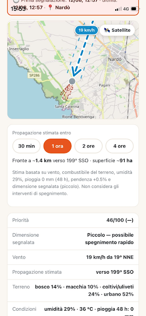
• The map shows the estimate, uncertainty area, wind, and propagation cone calibrated to the actual terrain (woods, scrub, cultivated land, urban areas), with critical areas highlighted in red.
TARGETED ALERTS
By registering (optional), you'll receive push notifications and emails only if your home is within the fire zone or the expected spread cone. Volunteers can declare their availability, range, and equipment, and confirm intervention on small fires.
ON SITE
If you're near a confirmed fire, you can report "fire extinguished" (verified by the operations room) or "raise alert." The "Call 112 or 1515" button provides all the information you need to report to emergency services: coordinates, direction, wind, expected spread.
PRIVACY
No account required. Your location is never public, photos are stripped of metadata, and data is automatically deleted after 30 days. Your profile can be deleted at any time.
IMPORTANT: Fire Sentinel does not replace emergency numbers. In case of fire, always call 112 or 1515.
© 2026 Gabriele Manca. All rights reserved. Unauthorized reproduction, copying, or reworking of the architecture, application logic, and content of this application is prohibited.
Similar Apps

Stop and Go Contractor
This app is to ensure safety of the workforce working on different Activities

MSIP Kraków
The MSIP application provides access to spatial data of the Kraków Municipality

Yolio
Fuel + toll + bridge: find out the true cost of your trip in seconds.
RMF — Redes Móveis Fixas
Explore the network. Understand the coverage.

Dubai Metro: Map & Routes
Offline Dubai Metro map, route planner, fares, journey times and dark mode.

CTB
Book a taxi or bus easily and securely — track your trip live and enjoy a comfortable and fast commute
