


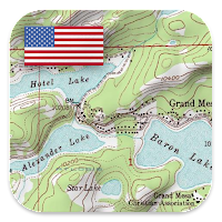
Outdoor / Offline GPS navigation with best maps for Great Britain.
+++ OUR NEW GPS APP +++
Easy to use Outdoor/Offline GPS navigation app with access to the best ORDNANCE SURVEY topographic maps and satellite images for UK (England, Wales & Scotland).
Turn your Andoid Phone/Tablet into an outdoor GPS for trips into the backcountry WITHOUT CELL COVERAGE. This app gives you similar mapping options as you might know from Garmin or Magellan GPS handhelds.
+++ Includes FREE OS 1:10.000 StreetView® maps ! +++
++ All topo maps are improved with HILLSHADING and contour lines generated from OS Terrain 50 - EXCLUSIVELY in this app ++
Included FREE map layers:
• OS Topo Maps: This layer combines OS VectorMap District™ and 1:10.000 OS StreetView® maps, enriched with hillshading, contour lines and additional placenames !
• OpenStreetMaps : These crowdsourced maps are a very useful addition to the OS maps
• OpenCycleMaps: These maps are ideal to plan bicycle trips
• Google Road Map (online access only)
• Google Satellite Images (online access only)
• Google Terrain Map (online access only)
• Bing Road Map (online access only)
• Bing Satellite Images (online access only)
• Earth At Night
• Hillshading overlay layer for OSM, Google or Bing maps
Available Premium Maps:
1:25.000 OS EXPLORER MAPS can be downloaded via In-App Purchase. Explorer maps costs vary from 5.5 £ to 28.5 £ per county (One time fee - Explorer maps can be installed on all devices that are logged to purchasers Google account). For example the whole county of Aberdeenshire as 1:25.000 Explorer maps costs only 15.45 £.
And: With the purchase of a 1:25.000 Explorer map cache pack ALL PRO Features WILL BE UNLOCKED !
All OS Explorer maps are in excellent quality with HILLSHADING (only in our app) !
Why should I obtain OS Explorer maps ? Answer: These are the best maps for hiking and other outdoor activities. Explorer maps contain many features (like small trails or points of interest) that are missing in other map sets.
Main features for outdoor-navigation:
• Create and edit Waypoints
• GoTo-Waypoint-Navigation
• Track Recording (with speed, elevation and accuracy profile)
• Tripmaster with fields for odometer, average speed, bearing, elevation, etc.
• GPX/KML/KMZ Export
• Search (placenames, POIs, streets)
• Customizable datafields in Map View and Tripmaster (e.g. Speed, Distance, Compass, ...)
• Share Waypoints, Tracks or Routes (via eMail, Whatsapp, Dropbox, Facebook, ..)
• Display coordinates in Lat/Lon, UTM or MGRS/USNG (Military Grid/ US National Grid)
• Record & share tracks with statistics & elevation profile
• Rotate map (Track Up & North Up)
• Get Elevation by long click on map
• Track Replay
• and many more ...
Available Pro features: (Pro features available via In App Purchase or come free when OS Explorer maps are purchased)
• Offline Use - no cell coverage needed
• Easy+Fast Bulk-download of map tiles for OFFLINE USAGE (not for Google and Bing maps)
• Create and edit Routes
• Route-Navigation (Point-to-Point Navigation)
• GPX/KML/KMZ Import
• unlimited Waypoints & Tracks
• Add Tile-Server
• No Ads
Offline Use:
All viewed map tiles are kept in cache. To cache large areas you need to purchase Pro features.
Use this navigation app for outdoor activities like hiking, biking, camping, climbing, riding, skiing, canoeing, hunting, offroad 4WD tours or search&rescue (SAR).
Add custom waypoints in longitude/latitude, UTM or MGRS/USNG format with WGS84 datum.
Import/Export/Share GPS-Waypoints/Tracks/Routes in GPX or Google Earth KML/KMZ format.
Preload FREE map data for areas without cell service (Pro feature !).
This app does NOT provide 1:50.000 OS Landranger maps: There is no need for the Landrangers as the included free OS Topo Map layer is better !
Comments and feature requests to [email protected]
Have a look at our other outdoor navigation apps: https://play.google.com/store/search?q=atlogis
+++ We DO NOT track any user activities or collect any user data ! +++
Easy to use outdoor navigation app with free access to the best...
Offroad Navigation App with worldwide topographic maps (mainly Russian General Staff). For...
+++ New GPS Mapping App +++ Easy to use Outdoor/Offline GPS...

Easy to use outdoor navigation app with the best topographic maps of...

Easy to use outdoor and navigation app with 1:50.000 topographic maps of...

Easy to use Outdoor/Offline GPS navigation app with access to the best...
Frequently Asked Questions(FAQ)


Created with AppPage.net
Similar Apps - visible in preview.