Mapas de España Básicos
10K+
Downloads

Everyone
info


About this app
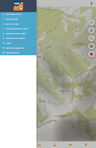
Designed to be very easy to use, without having to carry out any configuration you will be able to connect to the IGN services and the CNIG download center to obtain maps and routes.
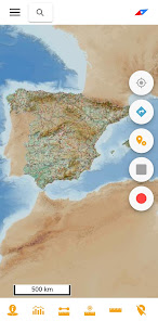
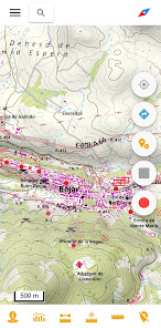
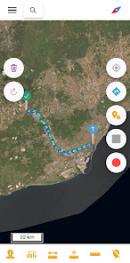
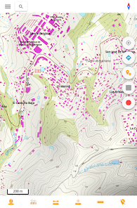
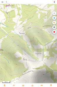
With this application you will be able to travel the routes of the National Parks or the stages of the Camino de Santiago or use your TRACKS/ROUTES, plan excursions using maps, navigation and guided tours, without the need for an internet connection after downloading data.
All the maps and routes used are free and allow you to:
- GPS location, even without mobile coverage
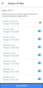
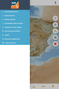
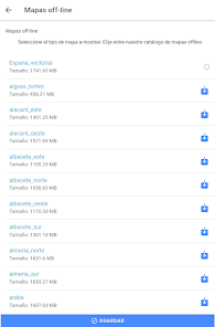
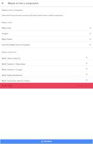
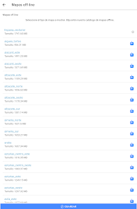
- Offline maps mode, saved in advance
- Draw routes (tracks) with GPS on the maps of the National Geographic Institute.
- Save and view the tracks in gpx, kml and kmz format.
- Track routes loaded in the application.
- Create your points of interest with the possibility of creating your own types of points of interest with associated forms.
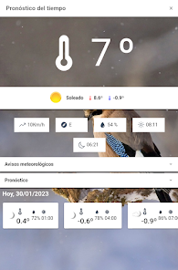
- Visualization of the positioning by coordinates, course, speed, altitude. Distance calculation.
- Augmented reality service, with important peaks and REGENT vertices.
- Access to emergency services, with a link to the AlertCops app, from the Secretary of State for Security.
- The application is in Spanish and English.
Official Publications Identification Number (NIPO): 162190351
With this application you will be able to travel the routes of the National Parks or the stages of the Camino de Santiago or use your TRACKS/ROUTES, plan excursions using maps, navigation and guided tours, without the need for an internet connection after downloading data.
All the maps and routes used are free and allow you to:
- GPS location, even without mobile coverage
- Offline maps mode, saved in advance
- Draw routes (tracks) with GPS on the maps of the National Geographic Institute.
- Save and view the tracks in gpx, kml and kmz format.
- Track routes loaded in the application.
- Create your points of interest with the possibility of creating your own types of points of interest with associated forms.
- Visualization of the positioning by coordinates, course, speed, altitude. Distance calculation.
- Augmented reality service, with important peaks and REGENT vertices.
- Access to emergency services, with a link to the AlertCops app, from the Secretary of State for Security.
- The application is in Spanish and English.
Official Publications Identification Number (NIPO): 162190351
Updated on
Safety starts with understanding how developers collect and share your data. Data privacy and security practices may vary based on your use, region, and age. The developer provided this information and may update it over time.

No data shared with third parties
Learn more about how developers declare sharing

No data collected
Learn more about how developers declare collection
What's new
Actualización de las librerías de carga de la cartografía vectorial para móviles


