

vGIS AR

5K+
Downloads

Everyone
info


About this app
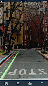
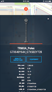
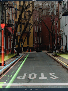
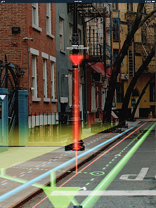
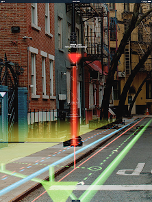
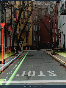
vGIS AR transforms traditional BIM and CAD designs and GIS data into real-time augmented reality displays that are overlaid on your view of a physical job site with centimeter-level accuracy.
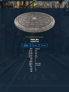
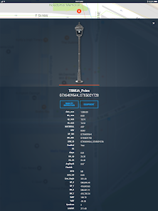
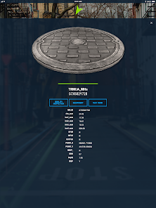
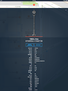
The system combines object holograms with object-specific data to provide a hands-free method for field technicians to understand the infrastructure they need to service while on site, quickly and safely.
Key features:
• Exceptional Accuracy
• Consistent Visualizations: 3D overlays stay “world-locked” by remaining in sync with the physical world
• Multi-Device Support
• No Additional Equipment: vGIS Utilities does not require any additional equipment
• Workflow Integration: vGIS Utilities integrates with your existing back-office systems
• Advanced Collaboration: Integrated holograms, video, and audio that connect the office with field teams
• Format Support: Esri Feature Services, Esri Map Services, Esri Scene Services, Esri Building Services, Bentley iTwin, WFS, WMS, WMTS, GeoJSON, KML
• GNSS Integration: Leica GG04 plus, EOS Arrow Series, SXBlue, TopCon and Trimble R series/Catalyst
• Multi-View Support: First-person on-site experience and birds-eye “zoom out” site overviews
Updated on
Safety starts with understanding how developers collect and share your data. Data privacy and security practices may vary based on your use, region, and age. The developer provided this information and may update it over time.

No data shared with third parties
Learn more about how developers declare sharing

This app may collect these data types
Location, Photos and videos and 4 others

Data is encrypted in transit

Data can’t be deleted
What's new
Amazing new features and bug fixes.