
Infor Field Inspector
3.2star
15 reviews
1K+
Downloads

Everyone
info
About this app
The Infor Field Inspector allows government inspectors and technicians to access their assigned work information from the field. Inspection results, project completion costs and status are updated immediately or synchronized at a later time if network connectivity is unavailable. Content can be modified through configuration. Designed to work with the Infor Public Sector application, field staff can quickly and efficiently perform the following:
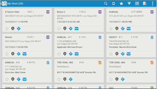
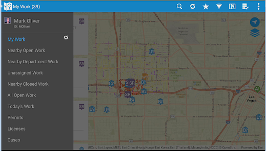
• Download, view, and edit their assigned permitting inspections, service requests, work orders and asset inspections
• Add comments and log entries
• Take and attach photos
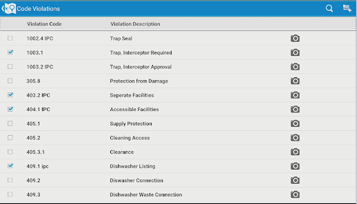
• Issue inspection based code violations
• Add multiple types of usage costs to work orders and service requests
• Add observations and sample units to asset inspections
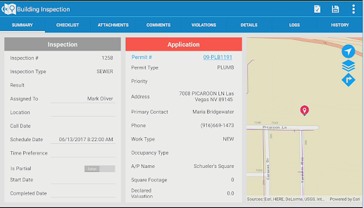
• View and modify agency specific detail information
• Print reports
• Create new service requests, CDR inspections, work orders, case records, and asset inspections
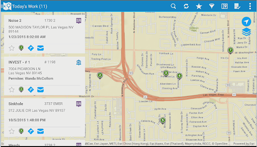
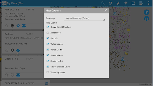
• Lookup assets and addresses from the map
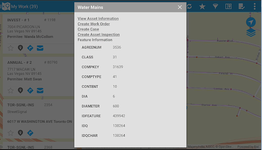
• Access and edit asset specific details
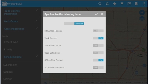
• Work disconnected or connected
Note: By downloading this mobile application, you acknowledge to reading and agreeing to the corresponding end user license agreement.
• Download, view, and edit their assigned permitting inspections, service requests, work orders and asset inspections
• Add comments and log entries
• Take and attach photos
• Issue inspection based code violations
• Add multiple types of usage costs to work orders and service requests
• Add observations and sample units to asset inspections
• View and modify agency specific detail information
• Print reports
• Create new service requests, CDR inspections, work orders, case records, and asset inspections
• Lookup assets and addresses from the map
• Access and edit asset specific details
• Work disconnected or connected
Note: By downloading this mobile application, you acknowledge to reading and agreeing to the corresponding end user license agreement.
Updated on
Safety starts with understanding how developers collect and share your data. Data privacy and security practices may vary based on your use, region, and age. The developer provided this information and may update it over time.

No data shared with third parties
Learn more about how developers declare sharing

No data collected
Learn more about how developers declare collection
What's new
• Added support for automatic synchronization of deleted attachments from back office to the app.
• Added support to clear cache right from the login screen.
• Added support to add Watermark/Overlay on photos taken from the app.
• Added support to disable Auto zoom-out on map views.
• Added support for automatic synchronization of offline map content available.
• Added support for conditional display on global Work Order Detail Page.


