
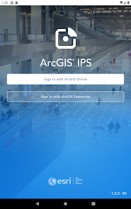
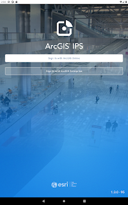
ArcGIS IPS Setup
1K+
Downloads

Everyone
info


About this app
ArcGIS IPS Setup for Android provides you with the necessary tools to take recordings of radio signals inside the facility you would like to equip with an indoor positioning system powered by ArcGIS IPS. Once you have your Bluetooth Low Energy Beacon infrastructure in place, use ArcGIS IPS Setup to survey your indoor spaces to enable the indoor blue dot.
ArcGIS IPS Setup is composed of five modes:
Map list: View map details, set favorites, open maps, and access the recordings menu from the map list.
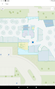
Default mode: Visualize floor plans, switch between floors in a facility, and access Plan mode from Default mode.
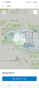
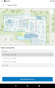
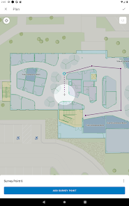
Plan mode: Sketch paths and add survey points to build a survey route before recording.
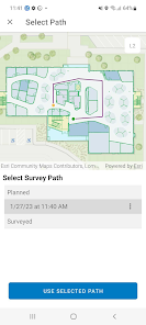
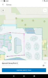
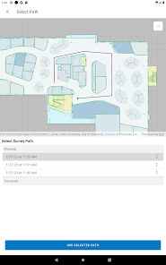
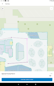
Survey mode: Collect radio reference data at an indoor site to build a record of trajectories, survey points, and locations, along with their corresponding geocoordinates.
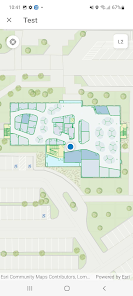
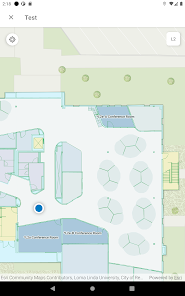
Test mode: Test a positioning file in Test mode after generating the file with the Generate Indoor Positioning File tool in ArcGIS Pro.
ArcGIS IPS Setup is composed of five modes:
Map list: View map details, set favorites, open maps, and access the recordings menu from the map list.
Default mode: Visualize floor plans, switch between floors in a facility, and access Plan mode from Default mode.
Plan mode: Sketch paths and add survey points to build a survey route before recording.
Survey mode: Collect radio reference data at an indoor site to build a record of trajectories, survey points, and locations, along with their corresponding geocoordinates.
Test mode: Test a positioning file in Test mode after generating the file with the Generate Indoor Positioning File tool in ArcGIS Pro.
Updated on
Safety starts with understanding how developers collect and share your data. Data privacy and security practices may vary based on your use, region, and age. The developer provided this information and may update it over time.

No data shared with third parties
Learn more about how developers declare sharing

No data collected
Learn more about how developers declare collection
What's new
Critical bug fix - stopping Quality Recording automatically


