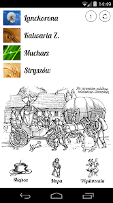
Lanckorona, Kalwaria Z. ...
500+
Downloads

Everyone
info
About this app
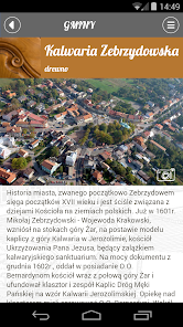
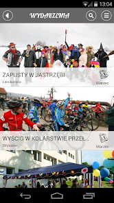
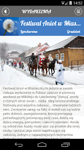
The mobile application "Lanckorona, Kalwaria Zebrzydowska, Mucharz, Stryszów" is a guide to the four municipalities of the south-western region of Little Poland - Lanckorona, Kalwaria Zebrzydowska, Mucharz and Stryszow, belonging to the Local Action Group "Tavern 4 Elements". In this located just 30 miles south of Krakow region begins two Beskid West - Makowski and small, ideal for hiking, biking or skiing. It is worth a visit and "feel" the space min. as Mannerist Architectural and Landscape Team and pilgrimage park of the seventeenth century (Basilica and Monastery oo. Bernardine in Kalwaria Zebrzydowska, kalwaryjskimi paths and Mountain Lanckorońska) - a UNESCO World Heritage Site, the monuments on the Trail of Wooden Architecture and unique wooden buildings Flood victim. This picturesque region lying on the Amber Road and the road St. James, attracts amateurs "unique atmosphere", rest in the bosom of nature, the eco-agro-tourism farms, historic guesthouses Flood victim, and since 2015 "running" is Lake Mucharski, the additional attraction of this beautiful corner of the Beskids. Local farmers offer healthy, organic and products produced in the region forming a local brand "Tastes of the 4 elements" and the local culture animators organize a lot of sensational events and artistic events, known in Poland, for example. Summer Music Festival in the Monastery oo. Bernardine International Guitar Workshop, and the December Festival "Angel in Small Town" in Lanckorona.
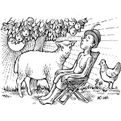
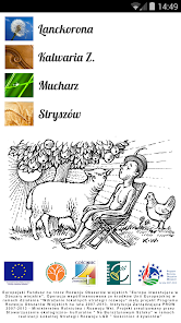
The application uses the drawings Mr. Kazimierz Wisniak - a well-known set designer, costume designer, painter, illustrator and graphic associated with Lanckorona.
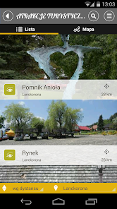
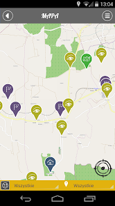
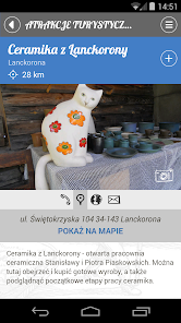
In the application, developed by Amistad Group based on the original technology Treespot, we find the most important tourist attractions of the region, as well as a collection of practical information, including catering facilities and accommodation, news about interesting events and developments and proposals trails. A very important function of the application is the user's geographic location - through the use of GPS technology, users of the application can check not only its location, but also preview, where there is a specific object. It also includes a planer, useful to explore in the area of selected objects. The application works in both online and offline on smartphones and mobile devices iOs and Android systems.
The application has been developed within the project Fri "Exploring Ecotourism highway 4 Elements - Guide mobile" implemented by the Ecological and Cultural Association "The Amber Route". European Agricultural Fund for Rural Development: Europe investing in rural areas. Event co-financed by the European Union under Axis 4 LEADER Rural Development Programme 2007-2013. Managing Authority of the Rural Development Programme for 2007-2013 Ministry of Agriculture and Rural Development.
Production: AmistadMobile.pl
The application uses the drawings Mr. Kazimierz Wisniak - a well-known set designer, costume designer, painter, illustrator and graphic associated with Lanckorona.
In the application, developed by Amistad Group based on the original technology Treespot, we find the most important tourist attractions of the region, as well as a collection of practical information, including catering facilities and accommodation, news about interesting events and developments and proposals trails. A very important function of the application is the user's geographic location - through the use of GPS technology, users of the application can check not only its location, but also preview, where there is a specific object. It also includes a planer, useful to explore in the area of selected objects. The application works in both online and offline on smartphones and mobile devices iOs and Android systems.
The application has been developed within the project Fri "Exploring Ecotourism highway 4 Elements - Guide mobile" implemented by the Ecological and Cultural Association "The Amber Route". European Agricultural Fund for Rural Development: Europe investing in rural areas. Event co-financed by the European Union under Axis 4 LEADER Rural Development Programme 2007-2013. Managing Authority of the Rural Development Programme for 2007-2013 Ministry of Agriculture and Rural Development.
Production: AmistadMobile.pl
Updated on
Safety starts with understanding how developers collect and share your data. Data privacy and security practices may vary based on your use, region, and age. The developer provided this information and may update it over time.

No data shared with third parties
Learn more about how developers declare sharing

This app may collect these data types
Device or other IDs

Data isn’t encrypted
Data can’t be deleted


