
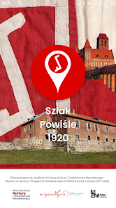
Szlak Powiśle 1920
5.0star
10 reviewsinfo
100+
Downloads

PEGI 3
info
About this app
An interactive guide to places related to the 1920 Plebiscite in Powiśle.
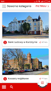
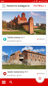
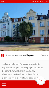
The Powiśle 1920 trail leads to places associated with events very important for the Polishness of the former Malbork Land, today called Powiśle, which was the struggle for their incorporation into the reborn Republic of Poland after the end of World War I. In Powiśle, this fight took the form of a plebiscite, i.e. giving the local population the opportunity to either opt for joining Poland or remain within the German borders. The preparations for and participation in the Plebiscite of 1920 became the moment of the greatest consolidation of activities for Polishness for Poles from Wisła, and despite losing the vote, resulted in the creation of numerous Polish organizations and the emergence of real heroes in the fight for Polishness. The routes of the trail lead to places related to the events before the Plebiscite of 1920 - centers of Polishness under the Prussian and then German partitions, to places where Poles acted to preserve the Polish language and Polish culture, then to places directly related to the organization of plebiscite voting and carrying it out, and finally to points on the map that went down in history after the Plebiscite, when its heroes, undaunted by the defeat, continued their activities and suffered its consequences, including the sacrifice of lives that many suffered after the start of World War II. It is the people and their biographies that are the most important in the story about the Plebiscite, so they received the most attention. Walking along the routes of the Powiśle 1920 Trail, we will meet Polish landowners, teachers, bankers, farmers and other people for whom the Polishness of Powiśle was the goal to which they devoted everything.
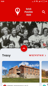
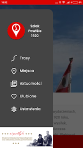
The Trail Powiśle 1920 application is a way to come into contact with a very important, though still little-known period in the history of the region. The list of facilities and routes will be constantly expanded. In this way, getting to know Powiśle and its history can be spread over time and explored at your own pace on foot, by bike or by car.
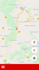
The application works offline, uses OpenStreetMap and GPS maps.
The project was financed by the Minister of Culture, National Heritage and Sport as part of the multi-annual program NIEPODLEGŁA 2017-2022.
© 2020 by the Castle Museum in Malbork
Production: Amistad.pl
The Powiśle 1920 trail leads to places associated with events very important for the Polishness of the former Malbork Land, today called Powiśle, which was the struggle for their incorporation into the reborn Republic of Poland after the end of World War I. In Powiśle, this fight took the form of a plebiscite, i.e. giving the local population the opportunity to either opt for joining Poland or remain within the German borders. The preparations for and participation in the Plebiscite of 1920 became the moment of the greatest consolidation of activities for Polishness for Poles from Wisła, and despite losing the vote, resulted in the creation of numerous Polish organizations and the emergence of real heroes in the fight for Polishness. The routes of the trail lead to places related to the events before the Plebiscite of 1920 - centers of Polishness under the Prussian and then German partitions, to places where Poles acted to preserve the Polish language and Polish culture, then to places directly related to the organization of plebiscite voting and carrying it out, and finally to points on the map that went down in history after the Plebiscite, when its heroes, undaunted by the defeat, continued their activities and suffered its consequences, including the sacrifice of lives that many suffered after the start of World War II. It is the people and their biographies that are the most important in the story about the Plebiscite, so they received the most attention. Walking along the routes of the Powiśle 1920 Trail, we will meet Polish landowners, teachers, bankers, farmers and other people for whom the Polishness of Powiśle was the goal to which they devoted everything.
The Trail Powiśle 1920 application is a way to come into contact with a very important, though still little-known period in the history of the region. The list of facilities and routes will be constantly expanded. In this way, getting to know Powiśle and its history can be spread over time and explored at your own pace on foot, by bike or by car.
The application works offline, uses OpenStreetMap and GPS maps.
The project was financed by the Minister of Culture, National Heritage and Sport as part of the multi-annual program NIEPODLEGŁA 2017-2022.
© 2020 by the Castle Museum in Malbork
Production: Amistad.pl
Updated on
Safety starts with understanding how developers collect and share your data. Data privacy and security practices may vary based on your use, region, and age. The developer provided this information and may update it over time.

No data shared with third parties
Learn more about how developers declare sharing

No data collected
Learn more about how developers declare collection

Data isn’t encrypted
Data can’t be deleted
Ratings and reviews
5.0
10 reviews


