
Bushfire.io
In-app purchases
50K+
Downloads

Everyone
info
About this app
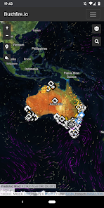
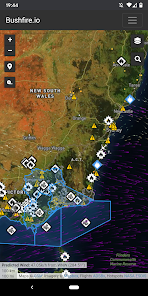
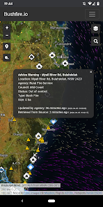
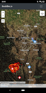
We integrate data from a variety of sources and provide a national view of fire events, fire hotspots, road closures, weather, and other critical bushfire information.
For fires, Bushfire.io now integrates information from a variety of feeds to show on one map:
- A national view of bushfire warnings and fire incidents.
- Detailed incident information (where available) for NSW, VIC, WA and ACT.
- Closed or hazardous roads.
- Recently burnt areas for VIC, QLD, and TAS.
- Bureau of Meteorology near-real-time weather observations.
- NOAA wind forecast (predicted wind) for the particle overlay.
- Major fire aircraft from ADSBx.
- Hotspots via NASA from NOAA-20, Suomi, Aqua and Terra.
Updated on
Safety starts with understanding how developers collect and share your data. Data privacy and security practices may vary based on your use, region, and age. The developer provided this information and may update it over time.


What's new
This update increases the SDK/API level to 33 (Android 13 / Android T).