
Transporte Pùblico CDMX Libre
Contains adsIn-app purchases

4.7star
1.33K reviews
100K+
Downloads

Everyone
info


About this app
What is Free CDMX Public Transportation (Without Internet)?
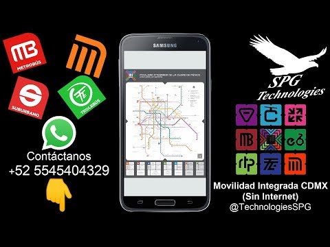
It is a simple application that allows you to open the maps of the public transportation network without having to have an Internet connection and show you all the lines of the Mexico City transportation system; such as the Metro, Metrobús, Light Train, Trolleybús, among others.
How does Free CDMX Public Transportation work (Without Internet)?
Through a PDF document viewer and incorporation of the official transport document, they make this your best option in places with little or no connection.
(ノ^_^)ノ How does it benefit me?
Easy direct access to a map of the Metro Lines, Metrobús, Light Rail, Trolleybus, among others.
This way you can optimize your times and/or routes to your destinations instantly!
➤More Features:
➟Now includes:
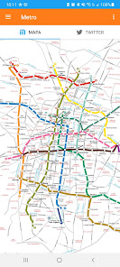
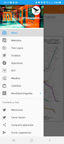
➣Metro Map
➣Metrobús Map
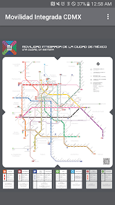
➣Light Rail Map
➣Trolleybus Map
➣Suburban Map
➣Mexibús Map
➟Works without the need for an Internet connection
➟Map updated to the year 2024
➟Integrated zoom
➟Easy way to give your suggestions via WhatsApp
➟Compatible with Android +4.4 devices
➟Constant updates
➟Instant incident correction
It is a simple application that allows you to open the maps of the public transportation network without having to have an Internet connection and show you all the lines of the Mexico City transportation system; such as the Metro, Metrobús, Light Train, Trolleybús, among others.
How does Free CDMX Public Transportation work (Without Internet)?
Through a PDF document viewer and incorporation of the official transport document, they make this your best option in places with little or no connection.
(ノ^_^)ノ How does it benefit me?
Easy direct access to a map of the Metro Lines, Metrobús, Light Rail, Trolleybus, among others.
This way you can optimize your times and/or routes to your destinations instantly!
➤More Features:
➟Now includes:
➣Metro Map
➣Metrobús Map
➣Light Rail Map
➣Trolleybus Map
➣Suburban Map
➣Mexibús Map
➟Works without the need for an Internet connection
➟Map updated to the year 2024
➟Integrated zoom
➟Easy way to give your suggestions via WhatsApp
➟Compatible with Android +4.4 devices
➟Constant updates
➟Instant incident correction
Updated on
Safety starts with understanding how developers collect and share your data. Data privacy and security practices may vary based on your use, region, and age. The developer provided this information and may update it over time.

No data shared with third parties
Learn more about how developers declare sharing

No data collected
Learn more about how developers declare collection
Ratings and reviews
4.7
1.32K reviews

Andres Vega
- Flag inappropriate
- Show review history
March 10, 2024
need to put an option to search

Fausto Karmacoma
- Flag inappropriate
February 1, 2024
Nice app

Thomas Trimble
- Flag inappropriate
February 12, 2024
Get that
What's new
➟Mapa incluye mapa MI, Metrobús y Trolebús ACTUALIZADO a 2024
➟Ahora cuenta con el Trolebús Elevado en calzada Ermita-Iztapalapa,
➤Más Características:
➟Mapa de Mexibús con Línea 1 hasta el AIFA
➟Cuenta con el mapa de Mexicable
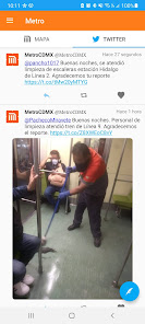
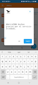
➨Puedes interactuar, reportar y mantenerte informado vía Twitter (en desarrollo).
Disfrútalo!!!
➟Ahora cuenta con el Trolebús Elevado en calzada Ermita-Iztapalapa,
➤Más Características:
➟Mapa de Mexibús con Línea 1 hasta el AIFA
➟Cuenta con el mapa de Mexicable
➨Puedes interactuar, reportar y mantenerte informado vía Twitter (en desarrollo).
Disfrútalo!!!
App support
phone
Phone number
+525545404329


