
Kentucky PowerMap
10+
Downloads

Everyone
info


About this app
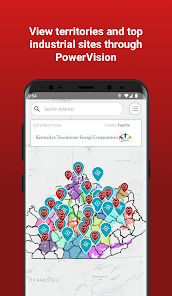
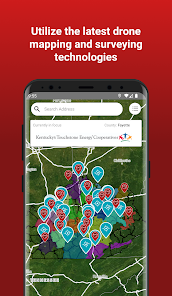
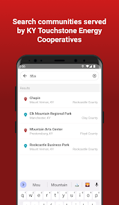
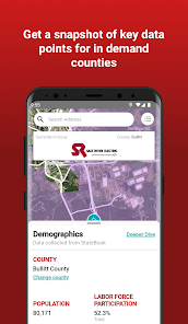
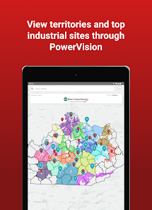
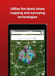
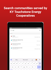
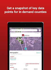
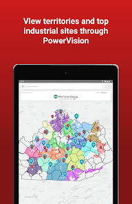
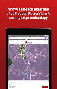
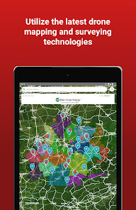
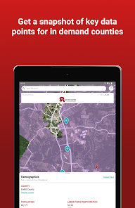
Created for Kentucky’s Touchstone Energy Cooperatives to provide cutting edge resources for economic developers around the world looking to locate industrial projects in sites with some of the lowest electric rates in the country. The first of its kind, PowerMap puts the power of locational knowledge in your hand with detailed co-operative service territory maps for all of our 87 counties served by the Kentucky Touchstone Energy Cooperatives. Type in an address or use your mobile device’s GPS capabilities to determine if you are in one of our 16 cooperatives' service territories. PowerMap leverages over 63,000 site selection data points from StateBook International, the premier data site for economic development site selectors (www.StateBook.com ) to locate the perfect location for your next great economic development project. Use the app to access geo-specific data such as: availability of skills, detailed workforce data, available sites and buildings, quality of life attributes, along with narratives and facts about the community and region. Visit www.DataIsPower.org for more information about PowerMap including the PowerMap web application and other initiatives being implemented by the Kentucky Touchstone Energy Cooperatives to make Kentucky the logical choice for your next economic development project.
Features:
• Detailed cooperative service territory maps for all of our 87 counties
served by the Kentucky Touchstone Energy Cooperatives
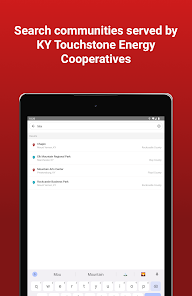
• Type in an address or use your mobile device’s GPS capabilities to
determine if you are in one of the 16 Kentucky Touchstone Energy
Cooperatives
• Access over 63,000 of the most recent site selection data points
leveraged through StateBook International, the premier data site for
economic development site selectors www.StateBook.com
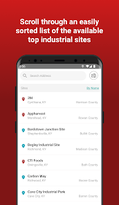
• Locate building sites and available buildings for potential economic
development opportunities in some of the lowest energy costs
regions of the country
• Determine service territory information whether you have a cell
signal or not
• Conceived by and built for Economic Developers to access pertinent
data in the quickest time frame
• Part of the suite of economic development efforts by the Kentucky
Touchstone Energy Cooperatives
Features:
• Detailed cooperative service territory maps for all of our 87 counties
served by the Kentucky Touchstone Energy Cooperatives
• Type in an address or use your mobile device’s GPS capabilities to
determine if you are in one of the 16 Kentucky Touchstone Energy
Cooperatives
• Access over 63,000 of the most recent site selection data points
leveraged through StateBook International, the premier data site for
economic development site selectors www.StateBook.com
• Locate building sites and available buildings for potential economic
development opportunities in some of the lowest energy costs
regions of the country
• Determine service territory information whether you have a cell
signal or not
• Conceived by and built for Economic Developers to access pertinent
data in the quickest time frame
• Part of the suite of economic development efforts by the Kentucky
Touchstone Energy Cooperatives
Updated on
Data safety
Developers can show information here about how their app collects and uses your data. Learn more about data safety

No information available
What's new
User Interface updates and new StateBook functionality.