DCS Nav
4.9star
25 reviews
1K+
Downloads

Everyone
info


About this app
For working You need to download and install Lua export script for DCS World from here:
https://github.com/pet333r/pw-dev_script
Detailed information on how to add a script to DCS World can be found on the same page
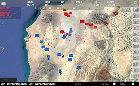
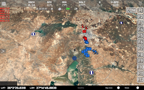
main functions:
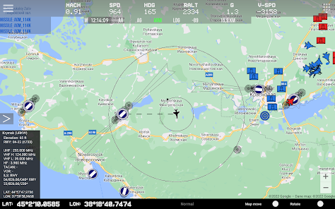
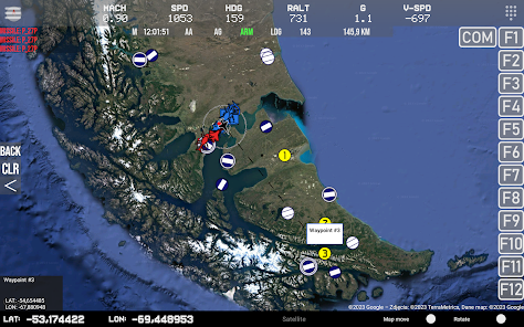
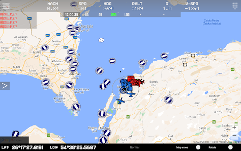
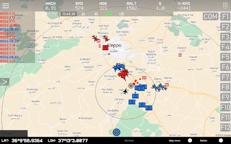
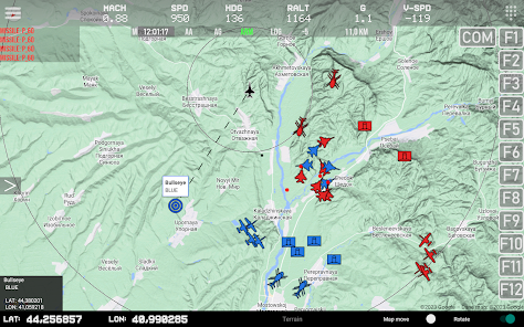
- displaying your own position and data (metric / imperial)
- displaying the radius of a circle around the user module
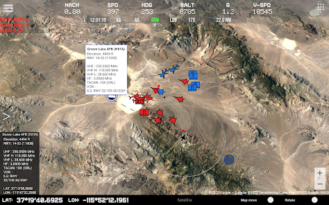
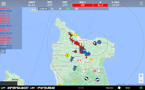
- displaying the position of other objects: airplanes, helicopters, ships
- SAM launcher position display
- displaying information about current missiles in the air
- displaying airports on the map with information
- display of available ILS tracks with navigation information
- display beacons (TACAN, NDB, VOR etc)
- displaying different icons depending on the type of object
- displaying map boundaries
- displaying NTTR boundaries
- displaying the line between the user and the selected object along with the current distance
- display of additional information (A/A, A/G, Arm, landing gear, distance to selected object)
- radio altitude limit warning
- change of frequency of data reception from DCS World for individual objects
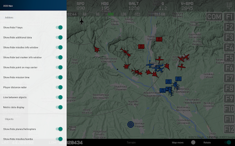
- ability to enable/disable displaying individual objects on the map
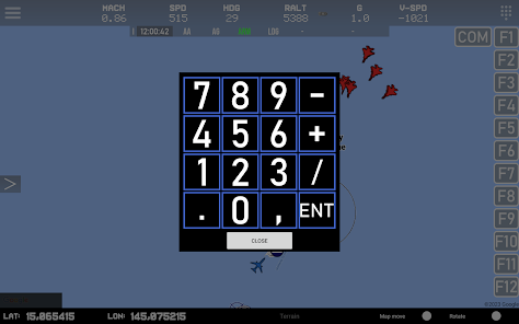
- option to add waypoints on the map (up to 5)
- change of map type
- display of GPS data in the following standards: DD / DMS
- side menu with the ability to quickly change the display of objects on the map
- support for DCS Util app
- works with any module
https://github.com/pet333r/pw-dev_script
Detailed information on how to add a script to DCS World can be found on the same page
main functions:
- displaying your own position and data (metric / imperial)
- displaying the radius of a circle around the user module
- displaying the position of other objects: airplanes, helicopters, ships
- SAM launcher position display
- displaying information about current missiles in the air
- displaying airports on the map with information
- display of available ILS tracks with navigation information
- display beacons (TACAN, NDB, VOR etc)
- displaying different icons depending on the type of object
- displaying map boundaries
- displaying NTTR boundaries
- displaying the line between the user and the selected object along with the current distance
- display of additional information (A/A, A/G, Arm, landing gear, distance to selected object)
- radio altitude limit warning
- change of frequency of data reception from DCS World for individual objects
- ability to enable/disable displaying individual objects on the map
- option to add waypoints on the map (up to 5)
- change of map type
- display of GPS data in the following standards: DD / DMS
- side menu with the ability to quickly change the display of objects on the map
- support for DCS Util app
- works with any module
Updated on
Safety starts with understanding how developers collect and share your data. Data privacy and security practices may vary based on your use, region, and age. The developer provided this information and may update it over time.

No data shared with third parties
Learn more about how developers declare sharing

No data collected
Learn more about how developers declare collection
Ratings and reviews
4.9
21 reviews

Per Feet
- Flag inappropriate
December 21, 2022
Very nice map to display on your android device. Very similar to the DCS F-10 map. Works great on both my Samsung phone and tablet. Great to look at the map without leaving the cockpit view and loosing situational awereness. Lots of cool settings/options what to view on the map.
2 people found this review helpful

Isaac Clear
- Flag inappropriate
July 23, 2022
Most Excellent! If your one of those people who F-10 to the map and back. Imagine a real time map where you can see contacts and even missiles. No more becoming a crater because you were browsing the map screen. #1Simple download script installer for P.C. #2Just go to script config in installed folder. Enter device IP address #3 Enter computers IP address in DCS NAV settings menu on your Device app. #4 Launch DCS open settings, Special Scroll left column down to PW dev.
5 people found this review helpful

Cary C
- Flag inappropriate
- Show review history
November 16, 2023
Great quick reference for when flying the Huey or Gazelle helicopters. Best use for an old tablet that I can find. Thanks Piotr.
What's new
- added Android 14
- added data display in MGRS format
- NS430 support
- module "directional" data corrected
- changed icons in Settings
- little fixes
- added data display in MGRS format
- NS430 support
- module "directional" data corrected
- changed icons in Settings
- little fixes


