
Mapit GIS - NTRIP Client
In-app purchases

4.2star
70 reviews
10K+
Downloads

Rated for 3+
info


About this app
This software is provided “AS IS” without any warranties of any kind so please be careful, especially if using it in any kind of real-time application.
Mapit NTRIP Client is fully compatible with Mapit GIS Data Collector version 6.0.0 and higher (available soon in the store).
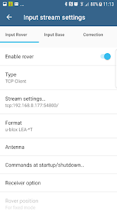
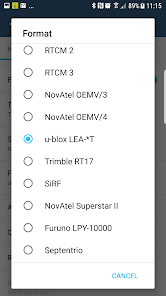
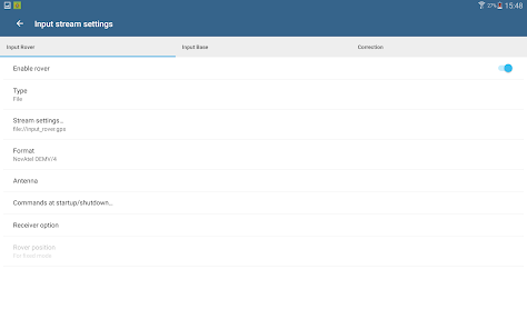
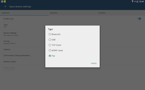
You can use any RTKLIB compliant GNSS with raw output connected via USB (ACM/PL2303/FTDI), Bluetooth, TCPIP or NTRIP.
To use this application with Mapit GIS Data Collector:
1. Install Mapit 6.0.0 or higher.
2. Instal Mapit NTRIP Client
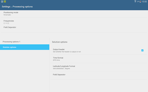
3. In Mapit go to settings->External GNSS and enable NTRIP Client
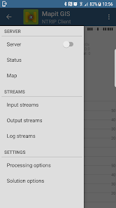
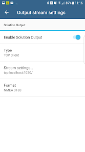
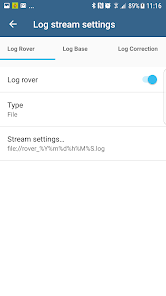
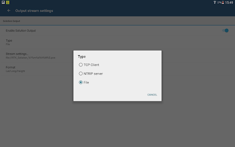
4. Set your input streams and start the RTK service
More detailed guide is available on our website:
http://mapit-gis.com/mapit-gis-ntrip-client/
NOTE: This application cannot process "standard" GPS data like those embedded into your phone or tablet. It has been tested with some external GNSS receivers but you need to determine yourself if this app suites your needs.
This application is using RTKLIB library and you need to have a supported GNSS receiver to be able to use it with this application. Before buying subscription please do ensure that your receiver is working well with the app - 7 days FREE Trial is available so you can test the application and see if it meets your needs.
The code for this application is based on RtkGps+ fromRonan LE MEILLAT and Alexey Illarionov. You'll find the original license in the "About/Legacy Info" screen. Thanks to all contributors to respect this original license clause.
This software is a port of RTKLIB 2.4.2p9 developed by Tomoki Takasu (http://www.rtklib.com).
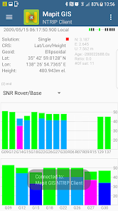
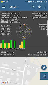
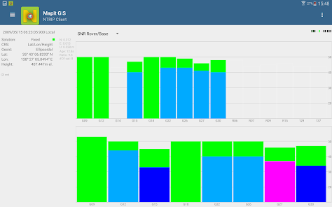
This application can compute precise GPS positions using RTKLIB algorithms (RTK or PPP) but for this you need a supported external GPS/GNSS with raw carrier phase output.
Mapit NTRIP Client is fully compatible with Mapit GIS Data Collector version 6.0.0 and higher (available soon in the store).
You can use any RTKLIB compliant GNSS with raw output connected via USB (ACM/PL2303/FTDI), Bluetooth, TCPIP or NTRIP.
To use this application with Mapit GIS Data Collector:
1. Install Mapit 6.0.0 or higher.
2. Instal Mapit NTRIP Client
3. In Mapit go to settings->External GNSS and enable NTRIP Client
4. Set your input streams and start the RTK service
More detailed guide is available on our website:
http://mapit-gis.com/mapit-gis-ntrip-client/
NOTE: This application cannot process "standard" GPS data like those embedded into your phone or tablet. It has been tested with some external GNSS receivers but you need to determine yourself if this app suites your needs.
This application is using RTKLIB library and you need to have a supported GNSS receiver to be able to use it with this application. Before buying subscription please do ensure that your receiver is working well with the app - 7 days FREE Trial is available so you can test the application and see if it meets your needs.
The code for this application is based on RtkGps+ fromRonan LE MEILLAT and Alexey Illarionov. You'll find the original license in the "About/Legacy Info" screen. Thanks to all contributors to respect this original license clause.
This software is a port of RTKLIB 2.4.2p9 developed by Tomoki Takasu (http://www.rtklib.com).
This application can compute precise GPS positions using RTKLIB algorithms (RTK or PPP) but for this you need a supported external GPS/GNSS with raw carrier phase output.
Updated on
Safety starts with understanding how developers collect and share your data. Data privacy and security practices may vary based on your use, region, and age. The developer provided this information and may update it over time.

No data shared with third parties
Learn more about how developers declare sharing

No data collected
Learn more about how developers declare collection
Ratings and reviews
4.2
65 reviews

A Google user
- Flag inappropriate
October 19, 2019
BE VERY AWARE that the "7 days FREE Trial" in the description is a con. I d/l the app on 13Oct and tried to stop the sub on 19Oct but I was prevented because the sub had already started on 16Oct!! I eventually discovered reading the manual on the website that trial period is in fact only 3 days. I feel deceived. I want to cancel as I can't get it to receive a fix from my Polaris Alpha despite trying various methods of connection ( Bluetooth/USB/TCP-IP) which is whole point of free trial to check
20 people found this review helpful

Robert Carl DeMuth
- Flag inappropriate
July 23, 2023
This is legitimately a reskinned version of RTKGPS+ (a free and open source tool) with a subscription baked in so that it is no longer free.

Duncan Barnes
- Flag inappropriate
March 25, 2022
Doesn't work with F9 connected via USB outputting NMEA and RTCM3 so can't test.
What's new
CHANGE: Update some urls templates to comply with Google security policy.


