
Landmarks in NY
10+
Downloads

Everyone
info


About this app
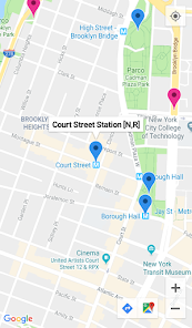
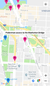
The aim of this App is to help you walk across both the Brooklyn and the Manhattan Bridge. It shows you where the nearest public transport stops are (blue pins) to optimize your routes. Use this map for directions to the pedestrian walkway from your starting destination.
This App is not a touristic guide but a way to enjoy and give you the best photo spots across both the Brooklyn and the Manhattan Bridge in New York which in my opinion are the most interesting. So turn your GPS on and enjoy!
This App is not a touristic guide but a way to enjoy and give you the best photo spots across both the Brooklyn and the Manhattan Bridge in New York which in my opinion are the most interesting. So turn your GPS on and enjoy!
Updated on
Safety starts with understanding how developers collect and share your data. Data privacy and security practices may vary based on your use, region, and age. The developer provided this information and may update it over time.

No data shared with third parties
Learn more about how developers declare sharing

No data collected
Learn more about how developers declare collection


