
IGN Terremotos
3.2star
1K reviewsinfo
100K+
Downloads

PEGI 3
info


About this app
Official application of the National Seismic Network (IGN. Ministry of Transport, Mobility and Urban Agenda) that allows the reception and visualization of all seismic events in Spain and surroundings on our Android device.
The main features of the application are:
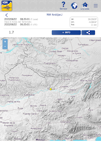
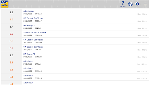
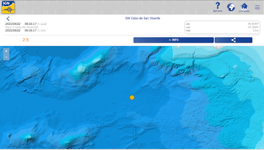
1.- Distance to the epicenter of the seismic event and epicentral parameters.
2.- Geolocation of the user's position and the epicenter.
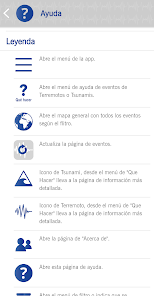
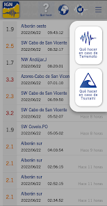
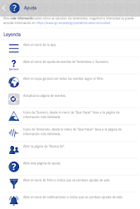
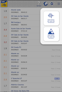
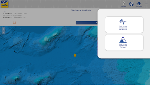
3.- In the event that there is a tsunami risk, it will be indicated by means of an icon on the screen (all the information can be found in the Main Menu, Help).
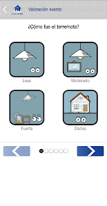
4.- In case of having felt an earthquake, possibility of sending a macroseismic form through simple animated icons.
5.- Possibility of sending a photograph to the RSN (National Seismic Network) in case of finding any damage or effect of the seismic event.
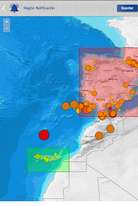
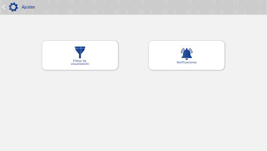
6.- Possibility of activating the service for sending notifications in the event of a seismic event.
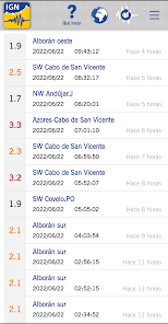
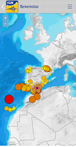
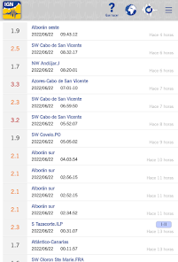
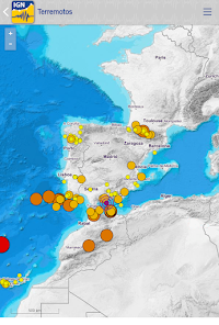
7.- General Map where you can see all the earthquakes
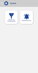
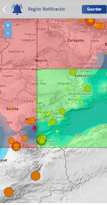
8.- Filters to show only earthquakes with particular parameters (minimum magnitude and region).
9.- Possibility of sharing the event through social networks, mail, etc...
10.- Access to detailed information for each event (IGN website)
11.- Information on "what to do in case of an earthquake" and "what to do in case of a tsunami"
Official Publications Identification Number (NIPO): 162190388
The main features of the application are:
1.- Distance to the epicenter of the seismic event and epicentral parameters.
2.- Geolocation of the user's position and the epicenter.
3.- In the event that there is a tsunami risk, it will be indicated by means of an icon on the screen (all the information can be found in the Main Menu, Help).
4.- In case of having felt an earthquake, possibility of sending a macroseismic form through simple animated icons.
5.- Possibility of sending a photograph to the RSN (National Seismic Network) in case of finding any damage or effect of the seismic event.
6.- Possibility of activating the service for sending notifications in the event of a seismic event.
7.- General Map where you can see all the earthquakes
8.- Filters to show only earthquakes with particular parameters (minimum magnitude and region).
9.- Possibility of sharing the event through social networks, mail, etc...
10.- Access to detailed information for each event (IGN website)
11.- Information on "what to do in case of an earthquake" and "what to do in case of a tsunami"
Official Publications Identification Number (NIPO): 162190388
Updated on
Safety starts with understanding how developers collect and share your data. Data privacy and security practices may vary based on your use, region, and age. The developer provided this information and may update it over time.

This app may share these data types with third parties
Messages

No data collected
Learn more about how developers declare collection

Data isn’t encrypted
Data can’t be deleted
Ratings and reviews
3.1
939 reviews

Jane Adams
- Flag inappropriate
July 26, 2022
0 out of 10 for this new version. Not able to open information about specific earthquakes even though I have received notifications. Map doesn't show locations either. The old version worked much better.
3 people found this review helpful
Centro Nacional de Información Geográfica - CNIG
July 27, 2022
Gracias por su comentario. Nos apuntamos la idea de abrir el detalle del sismo desde la notificación. Al acceder al detalle de cada terremoto, al dar a Lo he sentido te aparece la distancia al sismo.

Nigel Thomas
- Flag inappropriate
June 30, 2022
New Version doesn't work. In the ajustes section it is impossible to set a region filter because no map comes up. Also, you can't exit the app. Old version was fine!
2 people found this review helpful
Centro Nacional de Información Geográfica - CNIG
July 1, 2022
Gracias por su comentario. ¿No te aparece nada al seleccionar el filtro de visualización? ¿Podrías enviarnos capturas a consulta@cnig.es? Del tema de salir de la app nos lo apuntamos para próximas versiones.

Roger
- Flag inappropriate
- Show review history
November 18, 2021
This app is a great earthquake tracker for earthquakes in Spain and surrounding territories. It allowed me to see what is going on in La Palma with the earthquakes, that are near the volcano.
1 person found this review helpful
Centro Nacional de Información Geográfica - CNIG
November 19, 2021
Gracias por tu comentario.
What's new
Actualización del permiso de notificaciones.
Actualización del cuestionario de terremotos sentidos.
Actualización de librerías.
Corrección de errores.
Actualización del cuestionario de terremotos sentidos.
Actualización de librerías.
Corrección de errores.


