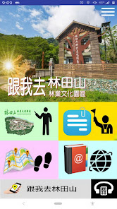
跟我去林田山
Contains ads
1+
Downloads

Everyone
info
About this app
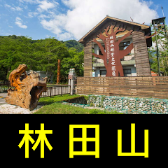
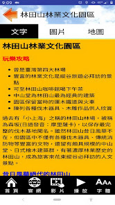
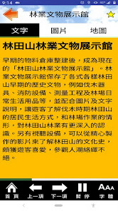
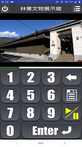
The Lintianshan Forestry Cultural Park preserves the most complete logging base in Taiwan. The park is rich in cultural relics such as various logging tools and traditional fire fighting equipment, as well as the Zhongshan Hall built of high-grade cypress, the Japanese-style cypress building complex, and the Lintian Mountain with a strong forestry history, which have become cultural attractions that tourists must visit in the East Rift Valley. This software collects and organizes the open data of the Huadong Rift Valley Scenic Area and the Forestry Bureau. The goal is to develop a practical action guide that is easy to use and free to download and experience Lintian Mountain, allowing users to easily explore Taiwan's most attractive forestry parks.
Function brief
--Text explanation and operation
--Browsing function of photo album
--Add text description to photo
--Voice commentary
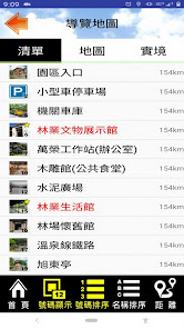
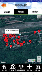
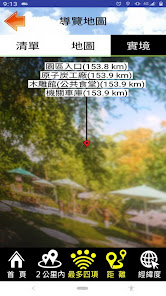
--Attraction list and real-world guidance function (Location VR)
--Spot name and distance sorting
--Users can mark key items
--Integrate Google Map to display location and navigation
--The map can be switched between standard and satellite mode
--720 live viewing, can be used with Cardboard VR navigation device (partial content)
--Practical digital audio guide function
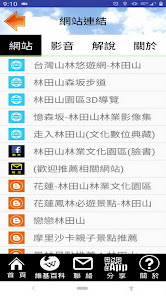
--Relevant blogs, websites and video links that can be categorized and organized
--Overall setting of interface font size
--Font size adjustment when text browsing (corresponding to the overall font setting)
- According to the user's mobile phone language setting, the appropriate interface language is given
--Add function keys for frequently used destination URLs
Permission description
--Background location permission: This application will access the current location, only to prompt nearby locations for navigation, display the relative location of the current location and attractions on the map, provide navigation, and support real-world azimuth and distance guidance, This is done even if the app is closed or not in use. The results of this location access will not be transmitted and used for other functions.
--Photo permission: This app will download photos and data for offline use, reduce cloud traffic, and make navigation smoother by reading data from mobile phones.
--Camera permission: This app provides AR positioning function to guide various attractions through the lens.
Function brief
--Text explanation and operation
--Browsing function of photo album
--Add text description to photo
--Voice commentary
--Attraction list and real-world guidance function (Location VR)
--Spot name and distance sorting
--Users can mark key items
--Integrate Google Map to display location and navigation
--The map can be switched between standard and satellite mode
--720 live viewing, can be used with Cardboard VR navigation device (partial content)
--Practical digital audio guide function
--Relevant blogs, websites and video links that can be categorized and organized
--Overall setting of interface font size
--Font size adjustment when text browsing (corresponding to the overall font setting)
- According to the user's mobile phone language setting, the appropriate interface language is given
--Add function keys for frequently used destination URLs
Permission description
--Background location permission: This application will access the current location, only to prompt nearby locations for navigation, display the relative location of the current location and attractions on the map, provide navigation, and support real-world azimuth and distance guidance, This is done even if the app is closed or not in use. The results of this location access will not be transmitted and used for other functions.
--Photo permission: This app will download photos and data for offline use, reduce cloud traffic, and make navigation smoother by reading data from mobile phones.
--Camera permission: This app provides AR positioning function to guide various attractions through the lens.
Updated on
Safety starts with understanding how developers collect and share your data. Data privacy and security practices may vary based on your use, region, and age. The developer provided this information and may update it over time.

No data shared with third parties
Learn more about how developers declare sharing

No data collected
Learn more about how developers declare collection
What's new
60 (2022.07.04) 初版
-- 支援正體中文
-- 支援正體中文


