Tokyo Map Old 2020
3.9star
116 reviews
10K+
Downloads

Rated for 3+
info
About this app
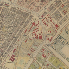
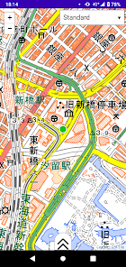
This software shows old map in Tokyo (1880s).
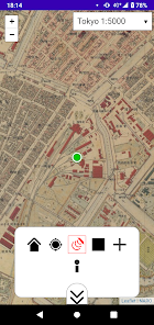
This software also supports "my location", so you can see the old map where you really stand on (only when you are in Tokyo or Kanto Area, Japan).
This software accesses "tile service" ( https://boiledorange73.sakura.ne.jp/ ) and GSI Tile ( https://maps.gsi.go.jp/development/ichiran.html ).
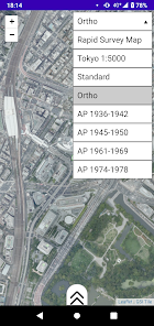
You can enjoy following maps:
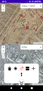
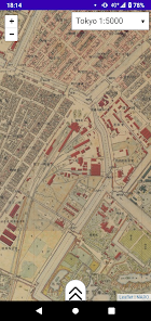
"Tokyo 1:5000" - 1:5000 map in Tokyo Central. Created on 1883 (Meiji 16).
"Rapid Survey Map in Kanto Plain" - 1:25000 map in Kanto Plain. Created on 1880 (Meiji 13) - 1886 (Meiji 19).
This software also supports "my location", so you can see the old map where you really stand on (only when you are in Tokyo or Kanto Area, Japan).
This software accesses "tile service" ( https://boiledorange73.sakura.ne.jp/ ) and GSI Tile ( https://maps.gsi.go.jp/development/ichiran.html ).
You can enjoy following maps:
"Tokyo 1:5000" - 1:5000 map in Tokyo Central. Created on 1883 (Meiji 16).
"Rapid Survey Map in Kanto Plain" - 1:25000 map in Kanto Plain. Created on 1880 (Meiji 13) - 1886 (Meiji 19).
Updated on
Safety starts with understanding how developers collect and share your data. Data privacy and security practices may vary based on your use, region, and age. The developer provided this information and may update it over time.

No data shared with third parties
Learn more about how developers declare sharing

No data collected
Learn more about how developers declare collection
Ratings and reviews
4.0
111 reviews

Rahman Pk
- Flag inappropriate
February 7, 2022
Good App but only Tokyo japan
6 people found this review helpful

Qudrat allah
- Flag inappropriate
August 6, 2021
نقشهر.دهراود
13 people found this review helpful

Zafar Jamali
- Flag inappropriate
August 25, 2023
ظفرجمالی
1 person found this review helpful
What's new
A new type of dual map view introduced.