Firemap
Contains ads
2.8star
328 reviews
100K+
Downloads

Everyone
info


About this app
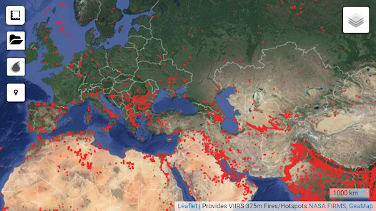
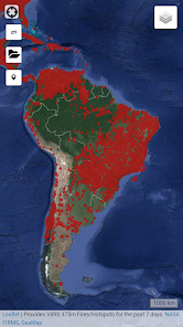
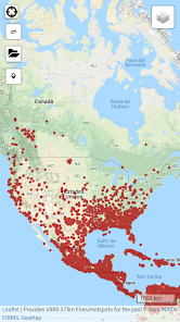
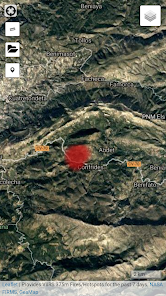
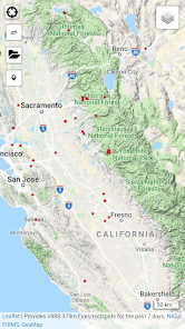
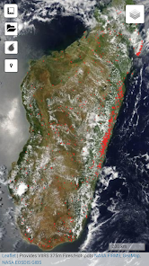
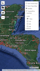
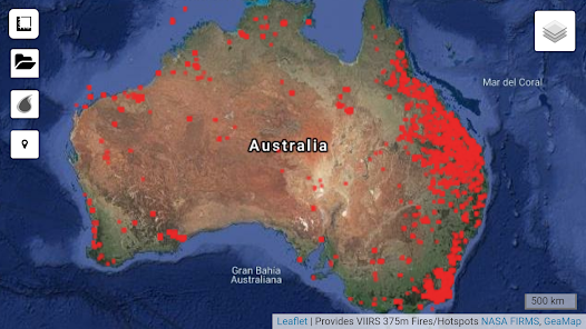
Firemap is a tool that allows you to visualize the latest fire events produced around the world. Quickly map the heat sources on a simple viewer allowing:
- Zoom in on the place
- Modify the cartographic database (orthophoto, topography and Open Street Map)
- Geopositioning through GPS
- Obtain data by measurements
- Draw maps with fire points
The cartography uses the data collected through the Terra satellite that NASA makes. This space detector carries with it different sensors, called MODIS and VIIRS, that capture the infrared radiation emitted by any fire. The information is treated quickly and made available to the public in a few hours. With all this we can know in a fairly objective way the approximate place where the fire occurred and the magnitude of it. More information at: http://ciencia.nasa.gov/science-at-nasa/2001/ast21aug_1/
Web:
http://www.geamap.com/en/fires
Updated on
Data safety
Developers can show information here about how their app collects and uses your data. Learn more about data safety

No information available
Ratings and reviews
2.8
317 reviews

Alice R
- Flag inappropriate
December 28, 2021
It's very useful it let's me know currently, like where there was a fire nearby in real time.
2 people found this review helpful

A Google user
- Flag inappropriate
June 9, 2019
doesn't pull up info on the fire. pops up banners for other apps/games
49 people found this review helpful

Nazimuddin Usmani
- Flag inappropriate
October 14, 2020
Good app, but not provide accurate place name.
8 people found this review helpful