
ArcGIS QuickCapture
3.9star
300 reviews
100K+
Downloads

Everyone
info


About this app
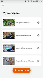
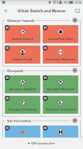
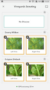
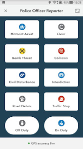
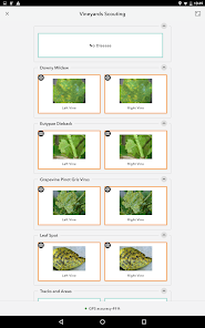
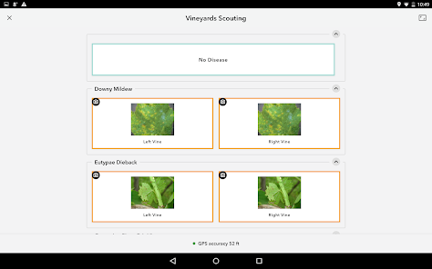
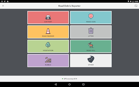
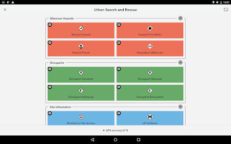
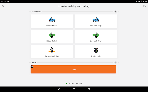
ArcGIS QuickCapture is the simplest way to capture field observations. Record GIS data with a single tap on your device. Automatically send locations, photos, and other attributes back to your office in real time. It’s integrated with ArcGIS, you can effectively visualize data you’ve never had access to before.
Updated on
Safety starts with understanding how developers collect and share your data. Data privacy and security practices may vary based on your use, region, and age. The developer provided this information and may update it over time.

No data shared with third parties
Learn more about how developers declare sharing

This app may collect these data types
Location, Personal info and 3 others

Data is encrypted in transit

You can request that data be deleted
Ratings and reviews
4.0
295 reviews

Nita Stonehocker
- Flag inappropriate
January 25, 2024
Even the event tech could not make it work. He had no idea why, and I was the only one who had a fully charged phone, so we had to finish on paper.

Gaurav Noel
- Flag inappropriate
May 31, 2020
This is an excellent App for capturing Data, it changes the way you can collect data on the go. Very user friendly and easy to set up if you know how to use Arc GIS. The Data is recieved Real Time. Amazing Features. A must for all the corporates to capture data. See what others cant
88 people found this review helpful

Vipin Kumar Maurya
- Flag inappropriate
- Show review history
July 10, 2021
ArcGIS QuickCapture app used for 30 Cr. Plantation is very neet and clean app without any lag, it work very fine as per name "QuickCapture" ..User your are requestd kindly follow the Proper instructions provided in manual. It is trust based license. Wich work in using proper credentials and URL.. Don't blame for your misunderstanding & malpractice to this App & go through the dashboard with the wich is open for Superving authorities which tell you the Success.
12 people found this review helpful
What's new
- ArcGIS field types date only, time only, and timestamp offset are supported.
- Dynamic choice lists supported.
- Unsent records may be symbolised to match either button icons, or symbology from the target layer.
- Dynamic choice lists supported.
- Unsent records may be symbolised to match either button icons, or symbology from the target layer.
App support
phone
Phone number
+19092556161


