eLiteMap
50+
Downloads

Everyone
info


About this app
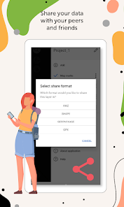
Collect field data, add and edit point, line, and polygon features on your mobile map, share your data with peers and friends.
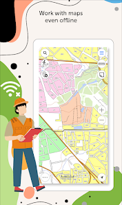
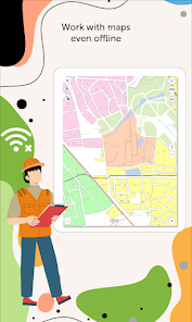
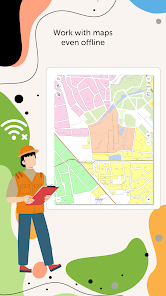
Access your maps everywhere you go, all app features are available even offline. eLiteMap provides seamless field work without authorization, payments and in-app purchases.
The app is available to a wide audience, including users without GIS skills.
1. Work in the app without authorization, payments and in-app purchases.
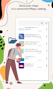
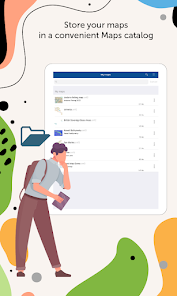
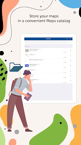
2. Store your maps in a convenient Maps catalog.
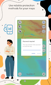
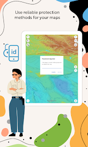
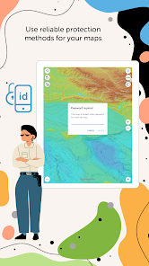
3. Use reliable protection methods for your maps.
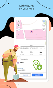
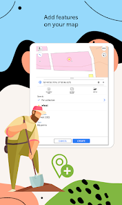
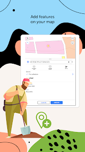
4. Create and edit point, line, and polygon features on map.
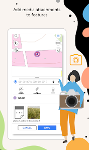
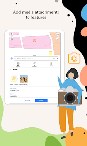
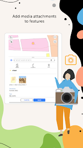
5. Add media attachments (photo, video and documents) to features.
6. Create points on-the-fly using your device camera.
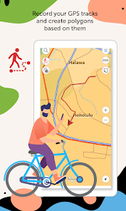
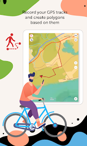
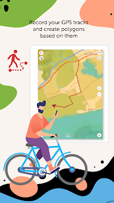
7. Record your GPS tracks and create polygons based on them.
8. Add graphic marks in the form of text, arrows or free hand graphic to the mobile map.
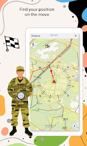
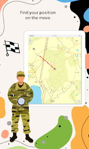
9. Use map features as landmarks or destination points.
10. Share collected data in GPKG, GPX, KML/KMZ and SHP formats.
11. Search and identify features offline.
12. Measure distances and areas.
13. Save selected map areas as bookmarks for quicker access.
eLiteMap allows you to solve problems in the fields of electricity, agriculture, geology, geodesy, environmental protection, housing and communal services, land and water resources management, ecology and incident management, city management, etc.
eLiteMap app is provided for work with maps of specific mobile format CMF2. To export your maps to this format, you will need eLiteMap Creator, a desktop application for creating CMF2 files from geodata of common formats and geo-referenced images of territories.
Visit https://elitemap.ru/en/elitemap-creator/overview/ to learn more about eLiteMap Creator.
To learn more about eLiteMap application, visit https://elitemap.ru/en/elitemap-app/overview/.
Your questions or comments are welcome at support@dataeast.com.
Access your maps everywhere you go, all app features are available even offline. eLiteMap provides seamless field work without authorization, payments and in-app purchases.
The app is available to a wide audience, including users without GIS skills.
1. Work in the app without authorization, payments and in-app purchases.
2. Store your maps in a convenient Maps catalog.
3. Use reliable protection methods for your maps.
4. Create and edit point, line, and polygon features on map.
5. Add media attachments (photo, video and documents) to features.
6. Create points on-the-fly using your device camera.
7. Record your GPS tracks and create polygons based on them.
8. Add graphic marks in the form of text, arrows or free hand graphic to the mobile map.
9. Use map features as landmarks or destination points.
10. Share collected data in GPKG, GPX, KML/KMZ and SHP formats.
11. Search and identify features offline.
12. Measure distances and areas.
13. Save selected map areas as bookmarks for quicker access.
eLiteMap allows you to solve problems in the fields of electricity, agriculture, geology, geodesy, environmental protection, housing and communal services, land and water resources management, ecology and incident management, city management, etc.
eLiteMap app is provided for work with maps of specific mobile format CMF2. To export your maps to this format, you will need eLiteMap Creator, a desktop application for creating CMF2 files from geodata of common formats and geo-referenced images of territories.
Visit https://elitemap.ru/en/elitemap-creator/overview/ to learn more about eLiteMap Creator.
To learn more about eLiteMap application, visit https://elitemap.ru/en/elitemap-app/overview/.
Your questions or comments are welcome at support@dataeast.com.
Updated on
Safety starts with understanding how developers collect and share your data. Data privacy and security practices may vary based on your use, region, and age. The developer provided this information and may update it over time.

No data shared with third parties
Learn more about how developers declare sharing

No data collected
Learn more about how developers declare collection
What's new
• New option to work with raster maps in MBTiles format.
• New ability to record and save voice comments (audio attachments) when creating and describing features on the map.
• New option to set and view Z coordinates of point features.
• New option to view information about traveled distance when moving to the destination point.
• Automatic creation of a point based on the user's location.